MyTopo
Neponset Reservoir NE Utah US Topo Map
Couldn't load pickup availability
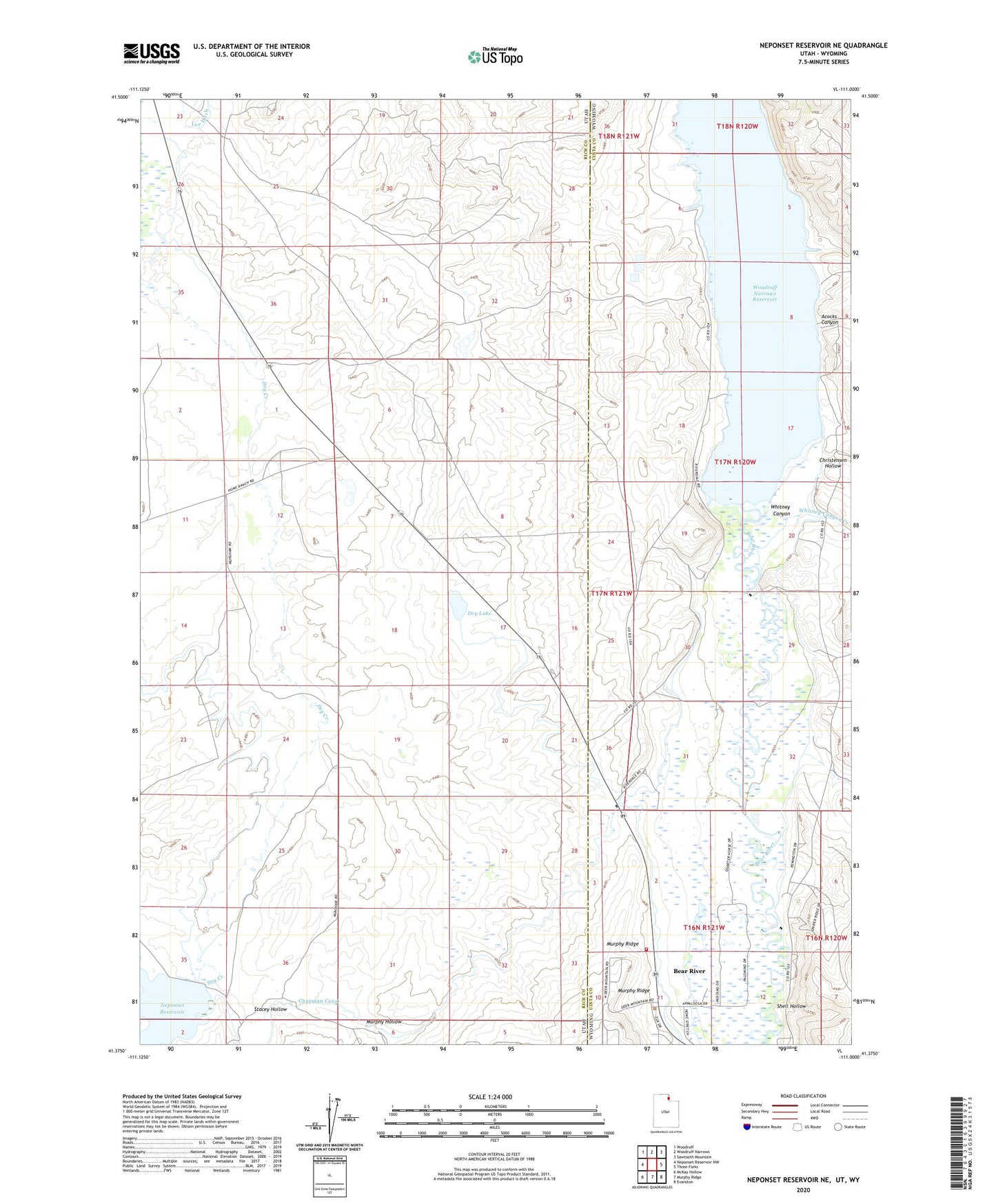
2020 topographic map quadrangle Neponset Reservoir NE in the states of Utah, Wyoming. Scale: 1:24000. Based on the newly updated USGS 7.5' US Topo map series, this map is in the following counties: Rich, Uinta. The map contains contour data, water features, and other items you are used to seeing on USGS maps, but also has updated roads and other features. This is the next generation of topographic maps. Printed on high-quality waterproof paper with UV fade-resistant inks.
Quads adjacent to this one:
West: Neponset Reservoir NW
Northwest: Woodruff
North: Woodruff Narrows
Northeast: Sawtooth Mountain
East: Three Forks
Southeast: Evanston
South: Murphy Ridge
Southwest: McKay Hollow
Contains the following named places: Acocks Canyon, Bear River, Chapman Canal, Christensen Ditch, Christensen Hollow, Crompton Ditch, Dry Lake, Fowkes Canyon Creek, Highway Ranch, Murphy Hollow, Murphy Ridge, Shell Hollow, Stacey Hollow, Town of Bear River, Tunnel Ditch, Uinta County Fire Protection Bear River, Whitney Canyon, Whitney Canyon Creek, Woodruff Narrows Reservoir