MyTopo
Paradise Utah US Topo Map
Couldn't load pickup availability
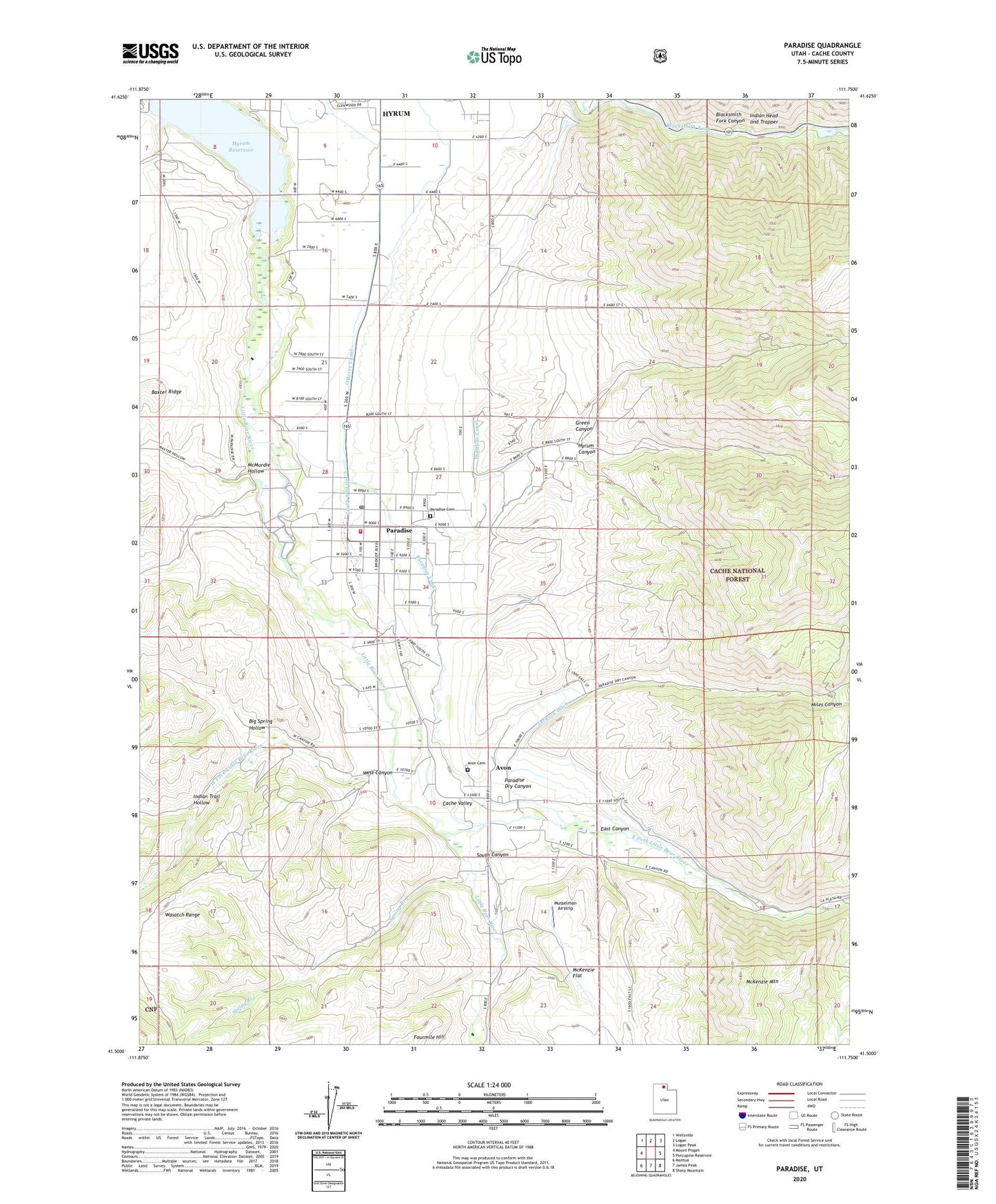
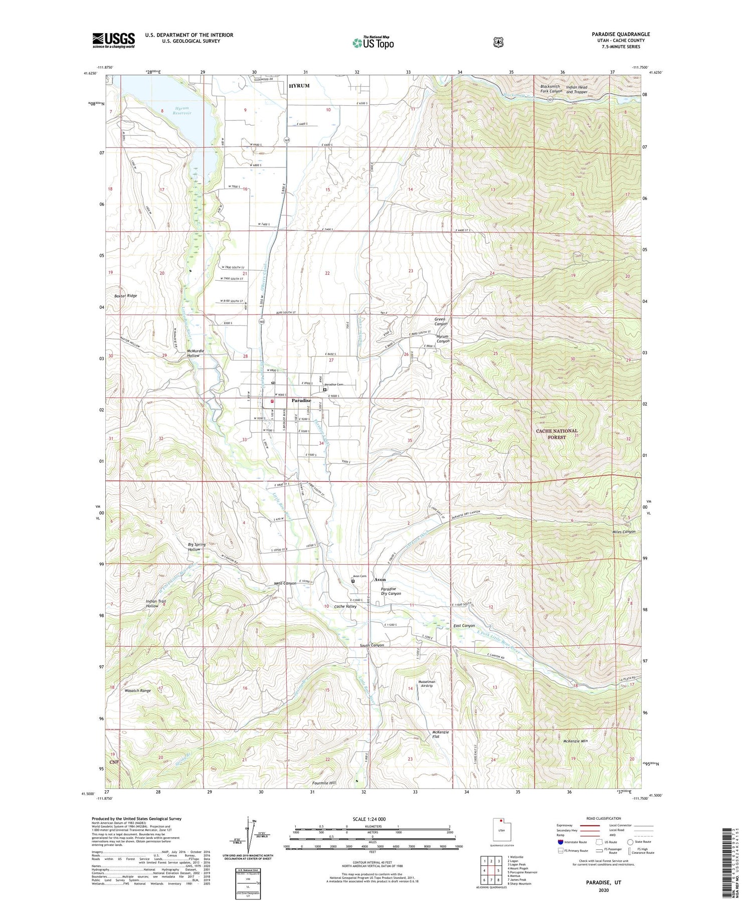
2020 topographic map quadrangle Paradise in the state of Utah. Scale: 1:24000. Based on the newly updated USGS 7.5' US Topo map series, this map is in the following counties: Cache. The map contains contour data, water features, and other items you are used to seeing on USGS maps, but also has updated roads and other features. This is the next generation of topographic maps. Printed on high-quality waterproof paper with UV fade-resistant inks.
Quads adjacent to this one:
West: Mount Pisgah
Northwest: Wellsville
North: Logan
Northeast: Logan Peak
East: Porcupine Reservoir
Southeast: Sharp Mountain
South: James Peak
Southwest: Mantua
Contains the following named places: Avon, Avon Cemetery, Avon Census Designated Place, Big Spring Hollow, Davenport Creek, East Canyon, East Fork Little Bear River, Fourmile Hill, Green Canyon, Highline Canal, Hyrum Canal, Hyrum Canyon, Hyrum Division, Hyrum Lake Campground, Hyrum Reservoir, Hyrum Reservoir State Park, Indian Head and Trapper, Indian Trail Hollow, Jackson Ditch, Little Bear River, McMurdie Hollow, Miles Canyon, Musselman Airstrip, O'Berry Canal, Paradise, Paradise Canal, Paradise Cemetery, Paradise Dry Canyon, Paradise Fire Department, Paradise Post Office, South Canyon, South Fork Little Bear River, Spring Branch, The Church of Jesus Christ of Latter Day Saints, Town of Paradise, West Canyon, West Fork Little Bear River, ZIP Code: 84328