
MyTopo
Rat Hole Ridge Utah US Topo Map
Couldn't load pickup availability
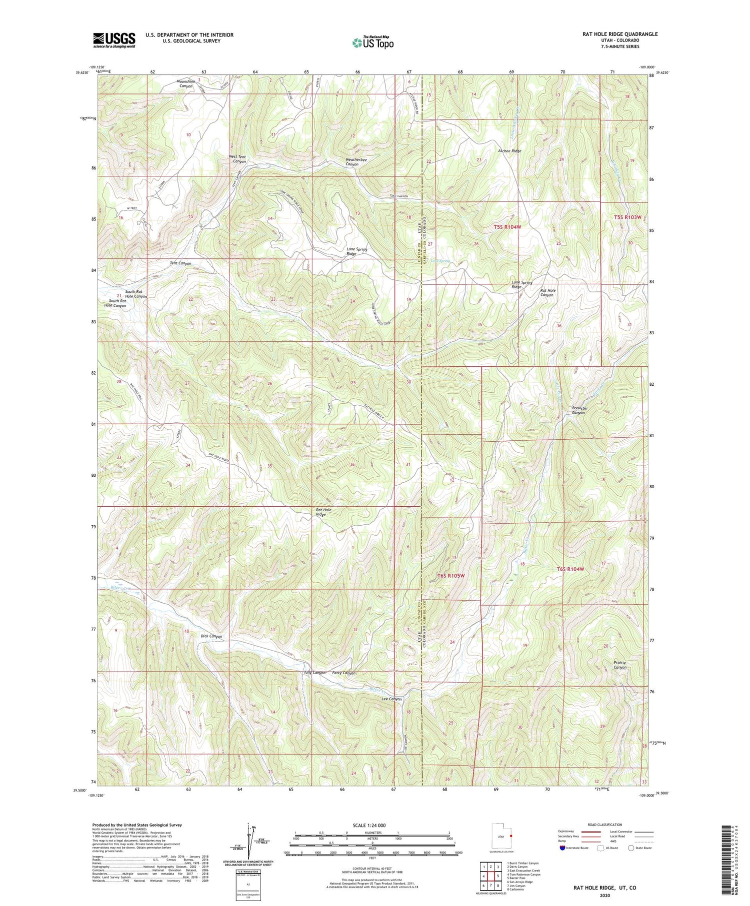
2020 topographic map quadrangle Rat Hole Ridge in the states of Utah, Colorado. Scale: 1:24000. Based on the newly updated USGS 7.5' US Topo map series, this map is in the following counties: Uintah, Garfield. The map contains contour data, water features, and other items you are used to seeing on USGS maps, but also has updated roads and other features. This is the next generation of topographic maps. Printed on high-quality waterproof paper with UV fade-resistant inks.
Quads adjacent to this one:
West: Tom Patterson Canyon
Northwest: Burnt Timber Canyon
North: Davis Canyon
Northeast: East Evacuation Creek
East: Baxter Pass
Southeast: Carbonera
South: Jim Canyon
Southwest: San Arroyo Ridge
Contains the following named places: Atchee Ridge, Brewster Canyon, Dick Canyon, Fatty Canyon, Hill Cow Camp, Lee Canyon, Little Water, Lone Spring, Lone Spring Ridge, Rat Hole Ridge, South Rat Hole Canyon, Tent Canyon, Tony Canyon, Weatherbee Canyon, West Tent Canyon


