
MyTopo
Baxter Pass Colorado US Topo Map
Couldn't load pickup availability
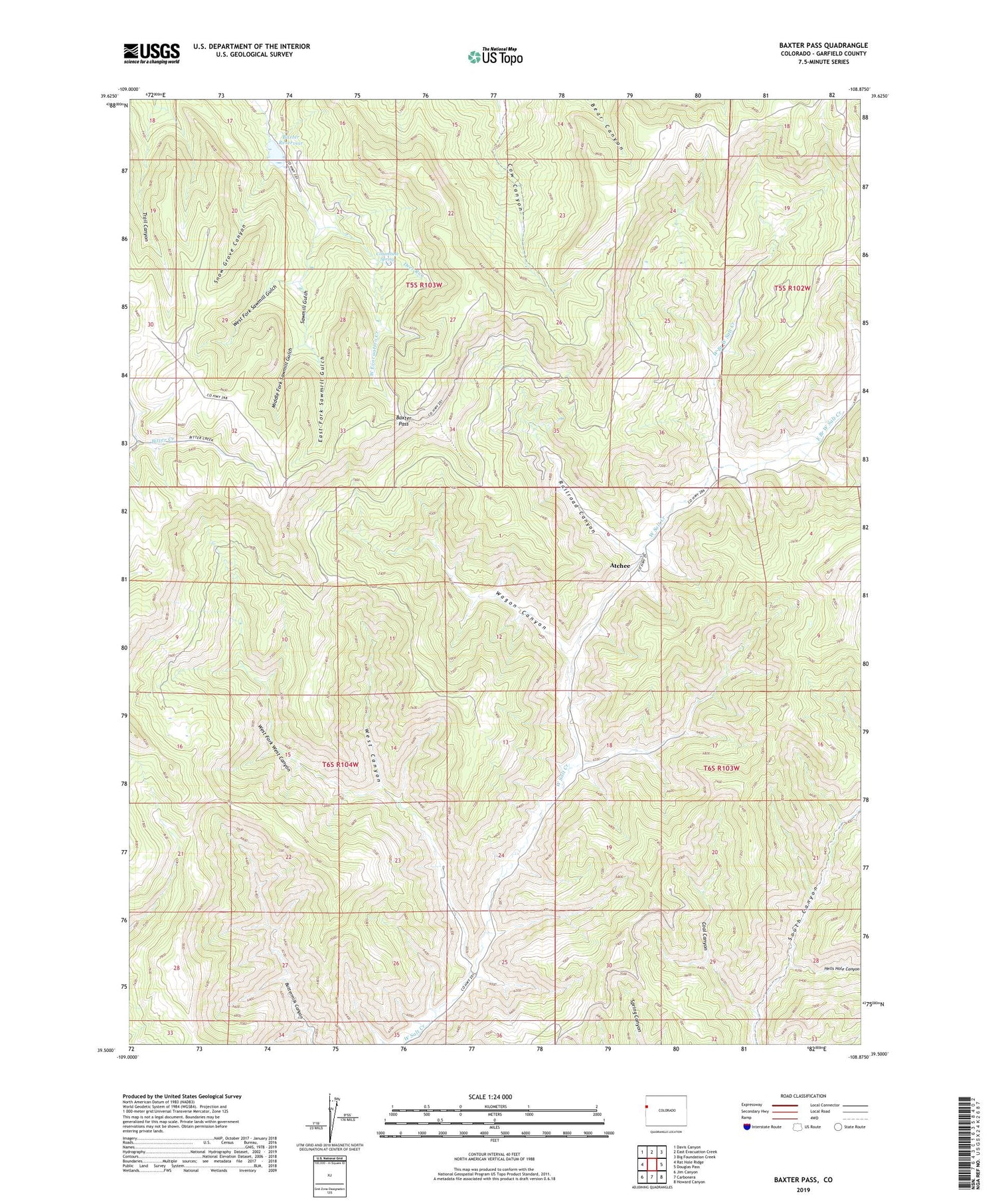
2022 topographic map quadrangle Baxter Pass in the state of Colorado. Scale: 1:24000. Based on the newly updated USGS 7.5' US Topo map series, this map is in the following counties: Garfield. The map contains contour data, water features, and other items you are used to seeing on USGS maps, but also has updated roads and other features. This is the next generation of topographic maps. Printed on high-quality waterproof paper with UV fade-resistant inks.
Quads adjacent to this one:
West: Rat Hole Ridge
Northwest: Davis Canyon
North: East Evacuation Creek
Northeast: Big Foundation Creek
East: Douglas Pass
Southeast: Howard Canyon
South: Carbonera
Southwest: Jim Canyon
This map covers the same area as the classic USGS quad with code o39108e8.
Contains the following named places: Atchee, Baxter Dam, Baxter Pass, Baxter Pass Heliport, Baxter Reservoir, Coal Canyon, Columbine Spring, Deer Run, East Branch West Salt Creek, East Fork Sawmill Gulch, Hells Hole Canyon, McAndrews Lake, Middle Fork Sawmill Gulch, Railroad Canyon, Sawmill Gulch, Snow Grove Canyon, Wagon Canyon, West Branch West Salt Creek, West Canyon, West Fork Sawmill Gulch, West Fork West Canyon


