
MyTopo
Rex Reservoir Utah US Topo Map
Couldn't load pickup availability
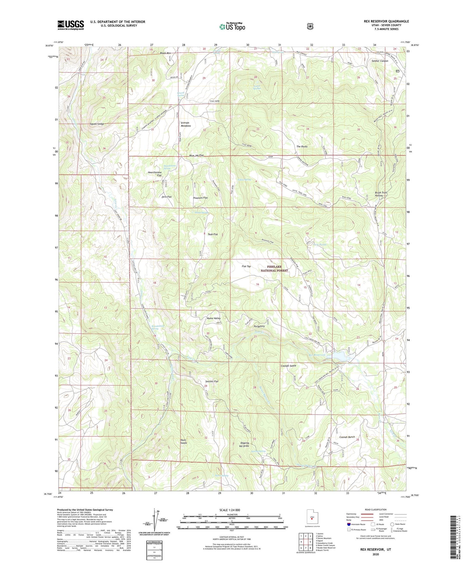
2020 topographic map quadrangle Rex Reservoir in the state of Utah. Scale: 1:24000. Based on the newly updated USGS 7.5' US Topo map series, this map is in the following counties: Sevier. The map contains contour data, water features, and other items you are used to seeing on USGS maps, but also has updated roads and other features. This is the next generation of topographic maps. Printed on high-quality waterproof paper with UV fade-resistant inks.
Quads adjacent to this one:
West: Sigurd
Northwest: Aurora
North: Salina
Northeast: Steves Mountain
East: Gooseberry Creek
Southeast: Mount Terrill
South: Boobe Hole Reservoir
Southwest: Water Creek Canyon
Contains the following named places: Blue Jay Flat, Coonah Bench, Coonah Swale, Dipping Vat Draw, Durfrey Homestead, Fallon Spring, Flat Top, Flowell Spring, Hearthstone Flat, Hearthstone Spring, Hock Swale, Josiah Springs, Kasov Spring, Kinnikinnick Spring, Kumo Valley, Little Lost Creek, Mud Spring, Pinenuts Flat, Prowse Spring, Purgatory, Rex Dam, Rex Reservoir, Scorups Meadows, Shoap Spring, Smithii Flat, Squaw Ledge, Swamp Spring, Sweet Water Creek, Teah Flat, The Rocks, Twin Ponds, Wine Creek, Zero Flat


