
MyTopo
Santaquin Utah US Topo Map
Couldn't load pickup availability
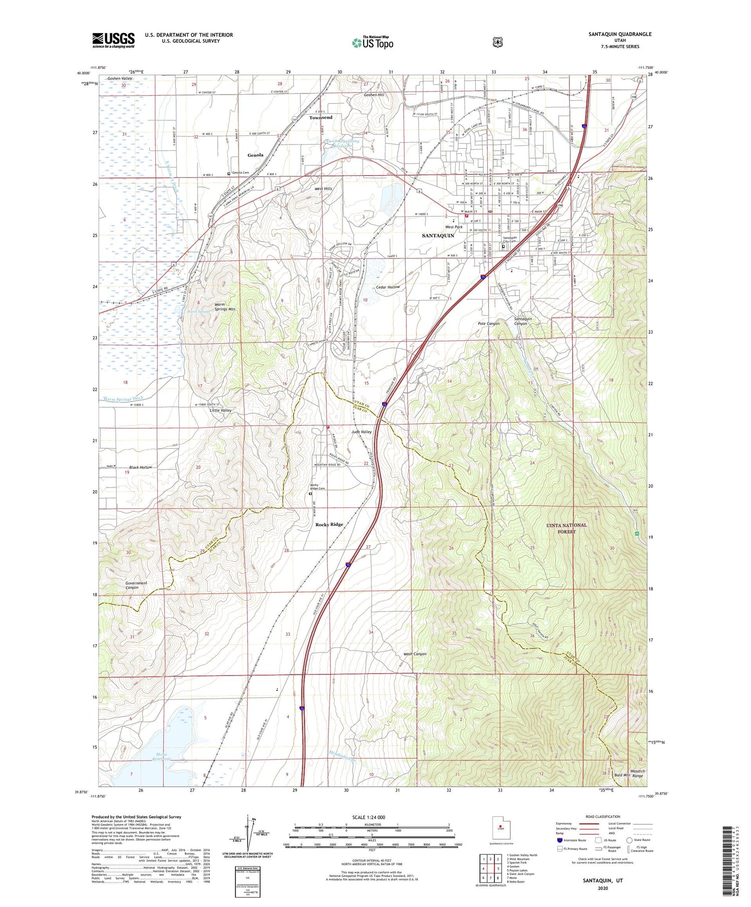
2020 topographic map quadrangle Santaquin in the state of Utah. Scale: 1:24000. Based on the newly updated USGS 7.5' US Topo map series, this map is in the following counties: Utah, Juab. The map contains contour data, water features, and other items you are used to seeing on USGS maps, but also has updated roads and other features. This is the next generation of topographic maps. Printed on high-quality waterproof paper with UV fade-resistant inks.
Quads adjacent to this one:
West: Goshen
Northwest: Goshen Valley North
North: West Mountain
Northeast: Spanish Fork
East: Payson Lakes
Southeast: Nebo Basin
South: Mona
Southwest: Slate Jack Canyon
Contains the following named places: Bald Mountain, Black Hollow, Bountiful Peak Picnic Area, C S Lewis Academy, Calvary Chapel Assembly of God Church, Cedar Hollow, City of Santaquin, East Warm Creek Ditch, Ewell Dam, Ewell Regulating Reservoir, Genola, Genola Cemetery, Goshen Hill, Little Valley, Mendenhall Creek, Mona Dam, Pole Canyon, Rocky Ridge, Rocky Ridge Cemetery, Rocky Ridge Fire Department, Santaquin, Santaquin Baptist Church, Santaquin Canyon, Santaquin City Ambulance, Santaquin City Cemetery, Santaquin Debris Basin Dam, Santaquin Debris Basin Reservoir, Santaquin Elementary School, Santaquin Fire Department, Santaquin Police Department, Santaquin Post Office, Starr 8, Summit Creek, Summit Creek Number Two Dam, Summit Creek Number Two Reservoir, The Church of Jesus Christ of Latter Day Saints, Town of Rocky Ridge, Townsend, Trumbolt Picnic Area, Warm Springs, Warm Springs Ditch, Warm Springs Mountain, Wash Canyon, West Park, ZIP Code: 84655


