MyTopo
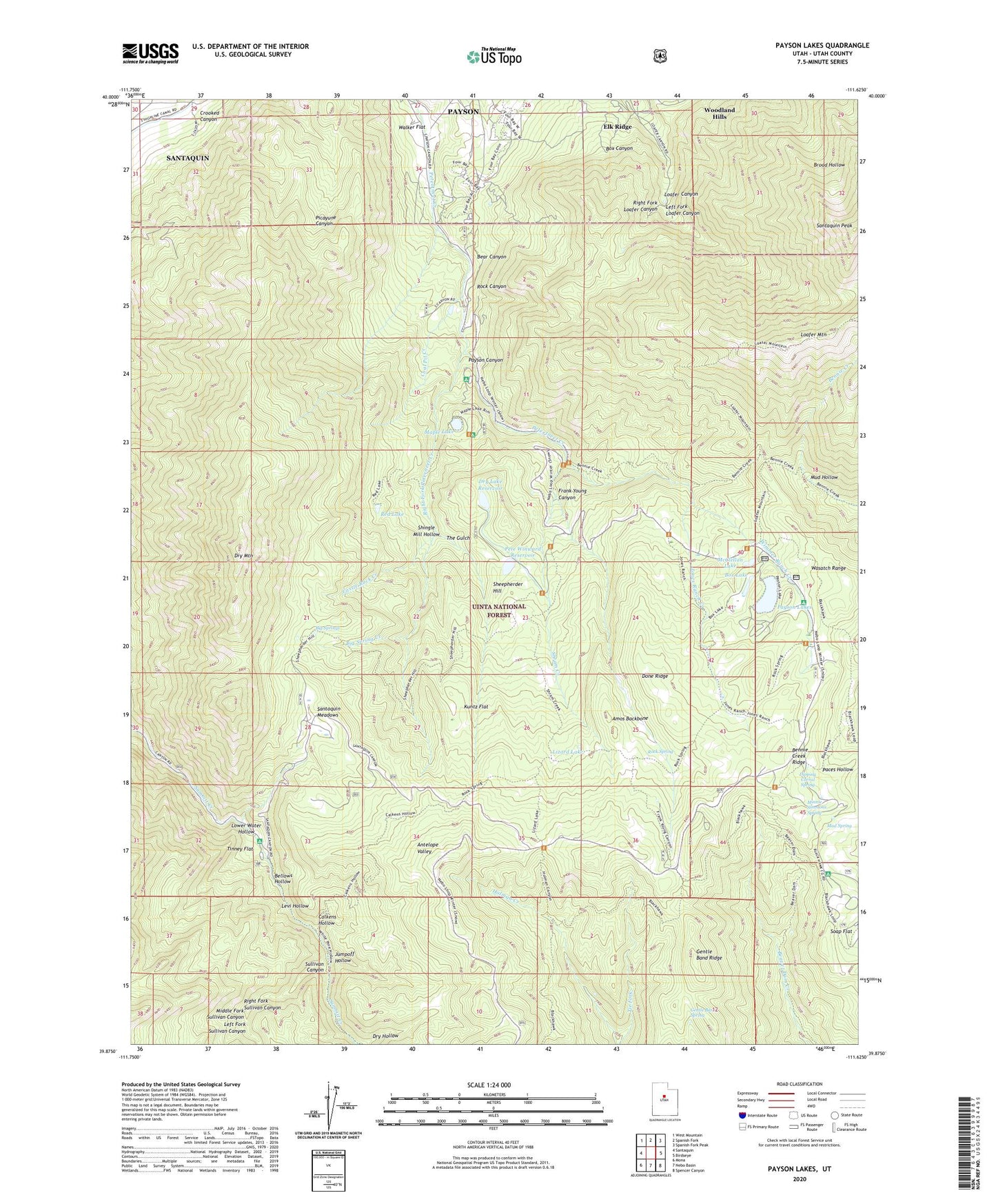
Payson Lakes Utah US Topo Map
Couldn't load pickup availability
Also explore the Payson Lakes Forest Service Topo of this same quad for updated USFS data
2023 topographic map quadrangle Payson Lakes in the state of Utah. Scale: 1:24000. Based on the newly updated USGS 7.5' US Topo map series, this map is in the following counties: Utah. The map contains contour data, water features, and other items you are used to seeing on USGS maps, but also has updated roads and other features. This is the next generation of topographic maps. Printed on high-quality waterproof paper with UV fade-resistant inks.
Quads adjacent to this one:
West: Santaquin
Northwest: West Mountain
North: Spanish Fork
Northeast: Spanish Fork Peak
East: Birdseye
Southeast: Spencer Canyon
South: Nebo Basin
Southwest: Mona
This map covers the same area as the classic USGS quad with code o39111h6.
Contains the following named places: Amos Backbone, Bear Canyon, Beaver Dam Overlook, Bellows Hollow, Bennie Creek Ridge, Big East Dam, Big East Reservoir, Big Spring Creek, Big Springs, Blackhawk Campground, Box Canyon, Box Lake, Calkens Hollow, Camp Koholowo, Castle Rock Creek, Coal Pit Creek, Crooked Canyon, Dipping Corral Spring, Done Ridge, Dry Hollow, Dry Lake Dam, Dry Lake Reservoir, Dry Mountain, Frank Young Canyon, Gentle Band Ridge, Gentle Band Spring, Golden Relief Mine, Jones Ranch Creek, Jumpoff Hollow, Kuntz Flat, Left Fork Loafer Canyon, Left Fork Sullivan Canyon, Levi Hollow, Lizard Lake, Lower Water Hollow, Maple Bench Campground, Maple Dell Camp, Maple Lake, Maple Lake Dam, McClellan Lake, McClellan Lake Dam, Middle Fork Sullivan Canyon, Minnie Simmons Spring, Mud Hollow, Mud Spring, Payson Lake Guard Station, Payson Lakes, Payson Lakes Campground, Pete Winward Dam, Pete Winward Reservoir, Red Lake, Right Fork Loafer Canyon, Right Fork Peteeneet Creek, Right Fork Sullivan Canyon, Rock Canyon, Rock Spring, Santaquin Meadows, Sheepherder Hill, Shingle Mill Hollow, Shram Creek, Soap Flat, Sullivan Canyon, Syndicate Mine, Taylor Fork, The Gulch, Tie Fork, Tinney Flat, Tinney Flat Campground, Walker Flat, Wimmer Ranch Creek, ZIP Code: 84651