MyTopo
Goshen Utah US Topo Map
Couldn't load pickup availability
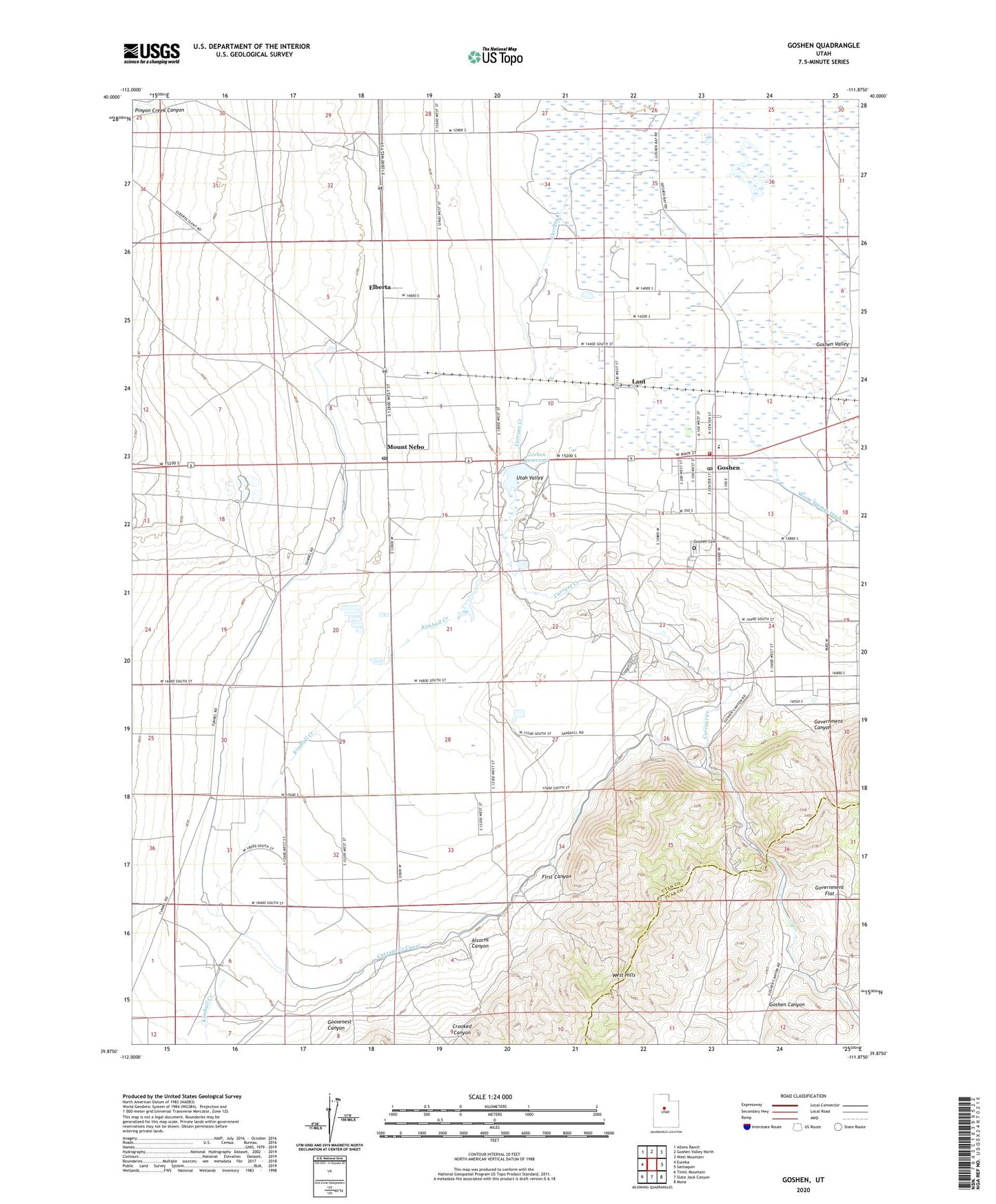
2023 topographic map quadrangle Goshen in the state of Utah. Scale: 1:24000. Based on the newly updated USGS 7.5' US Topo map series, this map is in the following counties: Utah, Juab. The map contains contour data, water features, and other items you are used to seeing on USGS maps, but also has updated roads and other features. This is the next generation of topographic maps. Printed on high-quality waterproof paper with UV fade-resistant inks.
Quads adjacent to this one:
West: Eureka
Northwest: Allens Ranch
North: Goshen Valley North
Northeast: West Mountain
East: Santaquin
Southeast: Mona
South: Slate Jack Canyon
Southwest: Tintic Mountain
This map covers the same area as the classic USGS quad with code o39111h8.
Contains the following named places: Alcorns Canyon, City Ditch, Crooked Canyon, Currant Creek, Currant Creek Canal, Elberta Census Designated Place, Elberta Post Office, First Canyon, Goosenest Canyon, Goshen, Goshen Canyon, Goshen Cemetery, Goshen Division, Goshen Elementary School, Goshen Fire Department, Goshen Post Office, Goshen Reservoir, Government Canyon, Government Flat, Kimball Creek, Lant, Mount Nebo, The Church of Jesus Christ of Latter Day Saints, Town of Goshen, ZIP Codes: 84626, 84633