MyTopo
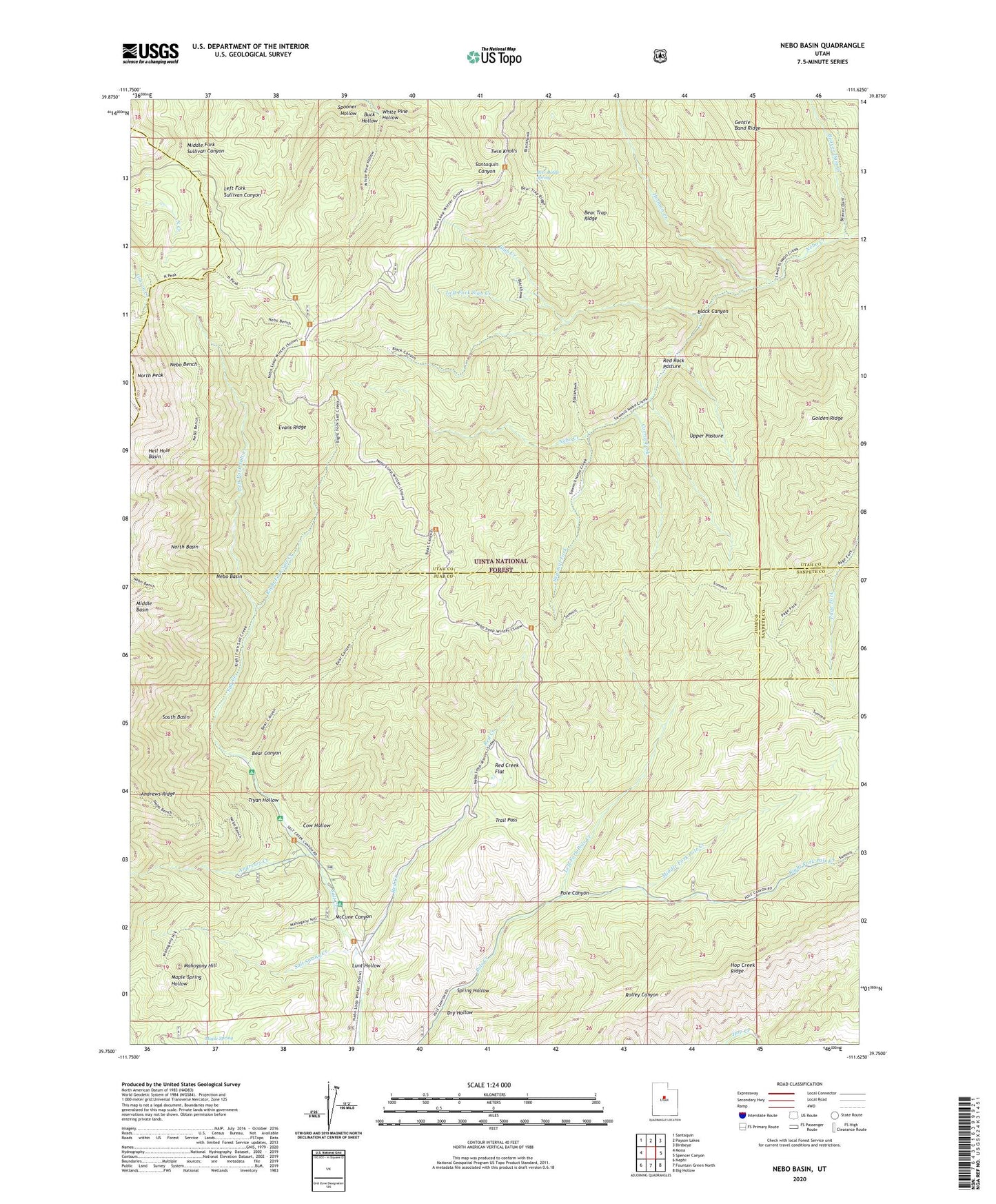
Nebo Basin Utah US Topo Map
Couldn't load pickup availability
Also explore the Nebo Basin Forest Service Topo of this same quad for updated USFS data
2023 topographic map quadrangle Nebo Basin in the state of Utah. Scale: 1:24000. Based on the newly updated USGS 7.5' US Topo map series, this map is in the following counties: Utah, Juab, Sanpete. The map contains contour data, water features, and other items you are used to seeing on USGS maps, but also has updated roads and other features. This is the next generation of topographic maps. Printed on high-quality waterproof paper with UV fade-resistant inks.
Quads adjacent to this one:
West: Mona
Northwest: Santaquin
North: Payson Lakes
Northeast: Birdseye
East: Spencer Canyon
Southeast: Big Hollow
South: Fountain Green North
Southwest: Nephi
This map covers the same area as the classic USGS quad with code o39111g6.
Contains the following named places: Andrews Creek, Andrews Ridge, Bear Canyon, Bear Canyon Picnic Area, Bear Trap Ridge, Beaver Dam Creek, Beer Bottle Spring, Black Canyon, Buck Hollow, Corral Fork, Cottonwood Campground, Cow Hollow, Devils Kitchen, Dry Hollow, Evans Ridge, Golden Ridge, Hell Hole Basin, Holman Creek, Kemo Creek, Left Fork Pole Creek, Left Fork Salt Creek, Left Fork Slab Creek, Lunt Hollow, Mahogany Hill, McCune Canyon, Middle Basin, Middle Fork Pole Creek, Nebo Basin, Nebo Basin Trail, Nebo Bench, Nebo Peak Trail, North Peak, Ponderosa Campground, Red Creek, Red Creek Flat, Red Rock Pasture, Right Fork Pole Creek, Right Fork Salt Creek, Salamander Lake, Salt Spring Creek, Sawmill Fork, Slab Creek, Spooner Hollow, Spring Hollow, Summit Trail, Trail Pass, Tryan Hollow, Twin Knolls, Upper Pasture, White Pine Hollow