MyTopo
Seep Flat Utah US Topo Map
Couldn't load pickup availability
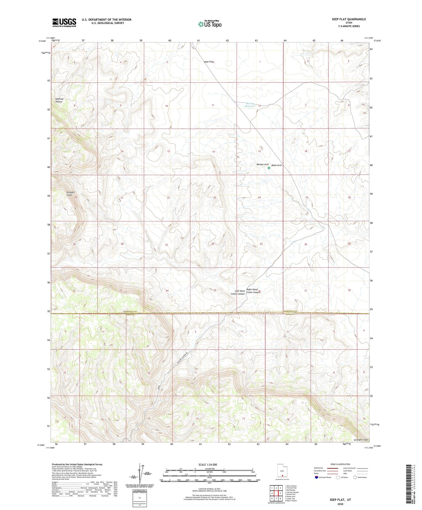
2023 topographic map quadrangle Seep Flat in the state of Utah. Scale: 1:24000. Based on the newly updated USGS 7.5' US Topo map series, this map is in the following counties: Garfield, Kane. The map contains contour data, water features, and other items you are used to seeing on USGS maps, but also has updated roads and other features. This is the next generation of topographic maps. Printed on high-quality waterproof paper with UV fade-resistant inks.
Quads adjacent to this one:
West: Carcass Canyon
Northwest: Dave Canyon
North: Tenmile Flat
Northeast: Red Breaks
East: Sunset Flat
Southeast: Basin Canyon
South: Collet Top
Southwest: Petes Cove
This map covers the same area as the classic USGS quad with code o37111e4.
Contains the following named places: Barney Reservoir, Devils Garden, Devils Garden Campground, Devils Garden Outstanding Natural Area, Left Hand Collet Canyon, Mano Arch, Metate Arch, Right Hand Collet Canyon, Seep Flat, Slickrock Water, Twentymile Corral