MyTopo
Dave Canyon Utah US Topo Map
Couldn't load pickup availability
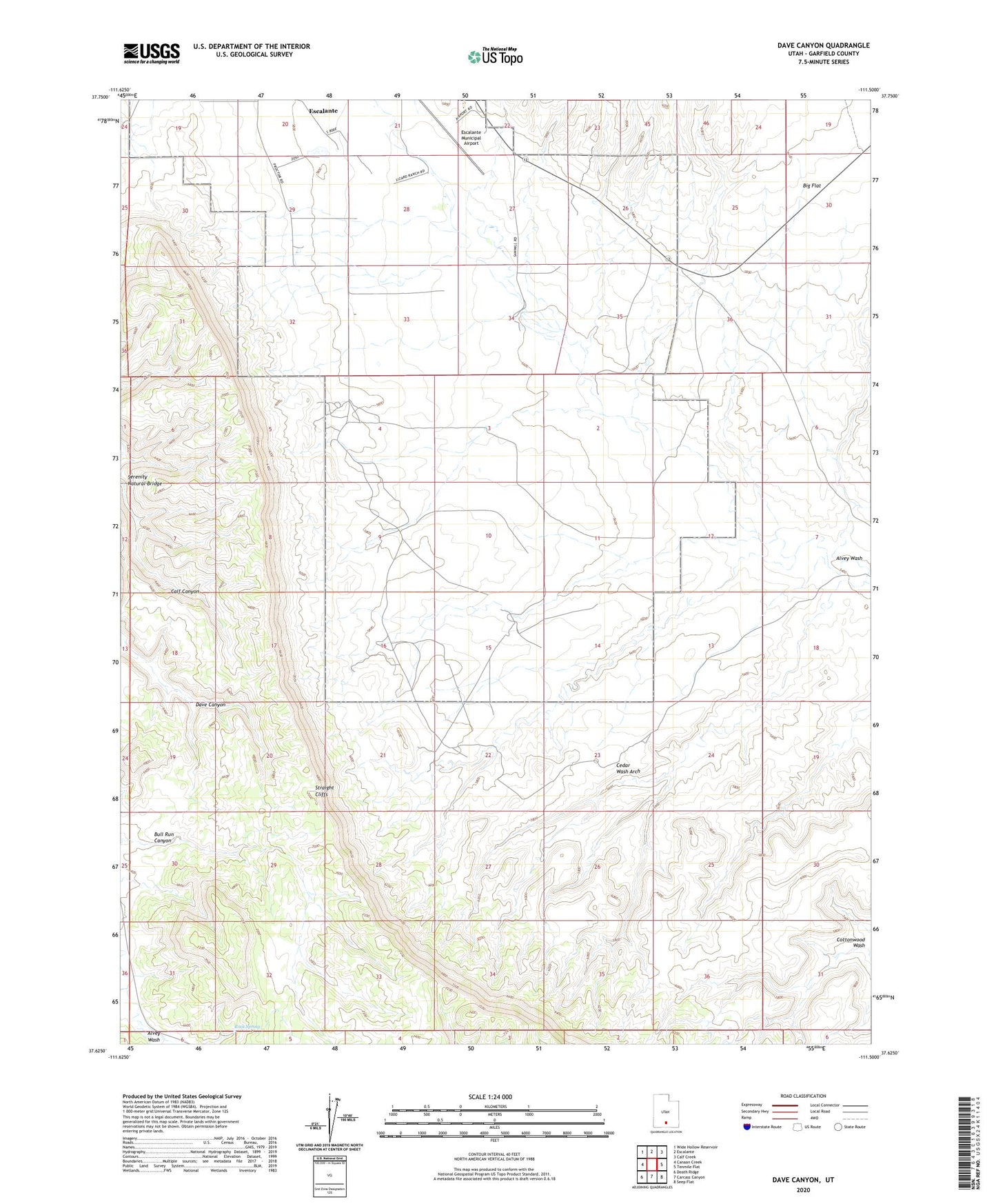
2023 topographic map quadrangle Dave Canyon in the state of Utah. Scale: 1:24000. Based on the newly updated USGS 7.5' US Topo map series, this map is in the following counties: Garfield. The map contains contour data, water features, and other items you are used to seeing on USGS maps, but also has updated roads and other features. This is the next generation of topographic maps. Printed on high-quality waterproof paper with UV fade-resistant inks.
Quads adjacent to this one:
West: Canaan Creek
Northwest: Wide Hollow Reservoir
North: Escalante
Northeast: Calf Creek
East: Tenmile Flat
Southeast: Seep Flat
South: Carcass Canyon
Southwest: Death Ridge
This map covers the same area as the classic USGS quad with code o37111f5.
Contains the following named places: Bull Run Canyon, Cedar Wash Arch, Escalante Municipal Airport, Rock Spring, Serenity Natural Bridge, ZIP Code: 84726