MyTopo
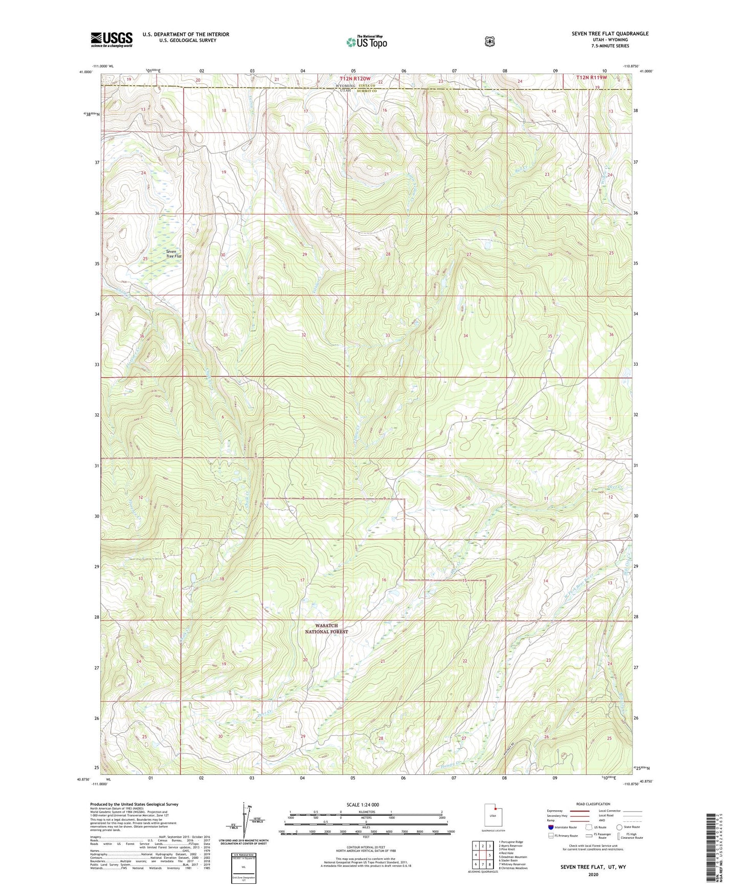
Seven Tree Flat Utah US Topo Map
Couldn't load pickup availability
Also explore the Seven Tree Flat Forest Service Topo of this same quad for updated USFS data
2023 topographic map quadrangle Seven Tree Flat in the state of Utah. Scale: 1:24000. Based on the newly updated USGS 7.5' US Topo map series, this map is in the following counties: Summit, Uinta. The map contains contour data, water features, and other items you are used to seeing on USGS maps, but also has updated roads and other features. This is the next generation of topographic maps. Printed on high-quality waterproof paper with UV fade-resistant inks.
Quads adjacent to this one:
West: Red Hole
Northwest: Porcupine Ridge
North: Myers Reservoir
Northeast: Pine Knoll
East: Deadman Mountain
Southeast: Christmas Meadows
South: Whitney Reservoir
Southwest: Slader Basin
Contains the following named places: Florence Creek, Humpy Creek, Mill City Creek, Seven Tree Flat