MyTopo
Pine Knoll Wyoming US Topo Map
Couldn't load pickup availability
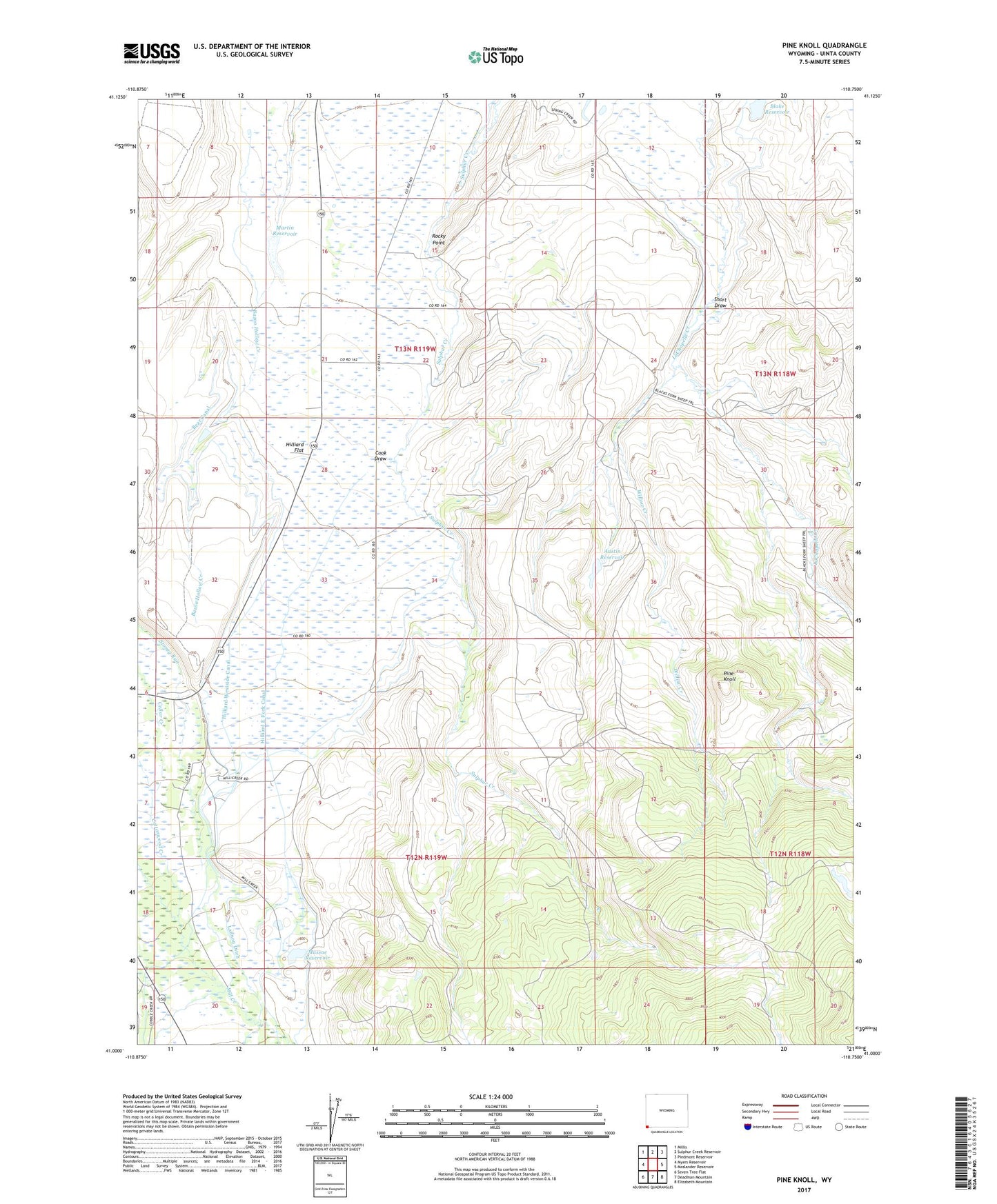
2021 topographic map quadrangle Pine Knoll in the state of Wyoming. Scale: 1:24000. Based on the newly updated USGS 7.5' US Topo map series, this map is in the following counties: Uinta. The map contains contour data, water features, and other items you are used to seeing on USGS maps, but also has updated roads and other features. This is the next generation of topographic maps. Printed on high-quality waterproof paper with UV fade-resistant inks.
Quads adjacent to this one:
West: Myers Reservoir
Northwest: Millis
North: Sulphur Creek Reservoir
Northeast: Piedmont Reservoir
East: Moslander Reservoir
Southeast: Elizabeth Mountain
South: Deadman Mountain
Southwest: Seven Tree Flat
This map covers the same area as the classic USGS quad with code o41110a7.
Contains the following named places: Austin Reservoir, Bear Canal, Blake Dam, Blake Reservoir, Cook Draw, Heber Dam, Hilliard East Fork Canal, Hilliard Flat, Hilliard Westside Canal, Martin Dam, Martin Reservoir, Massae Dam, Massae Reservoir, Pine Knoll, Rocky Point, Short Draw, Williard Ward Church, Willow Creek