MyTopo
Shearing Corral Utah US Topo Map
Couldn't load pickup availability
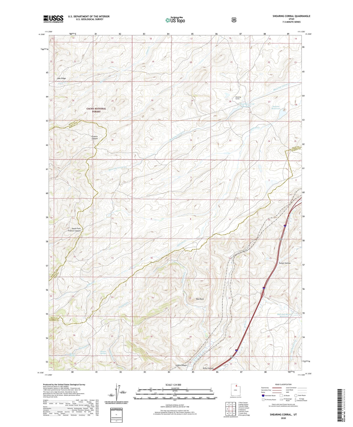
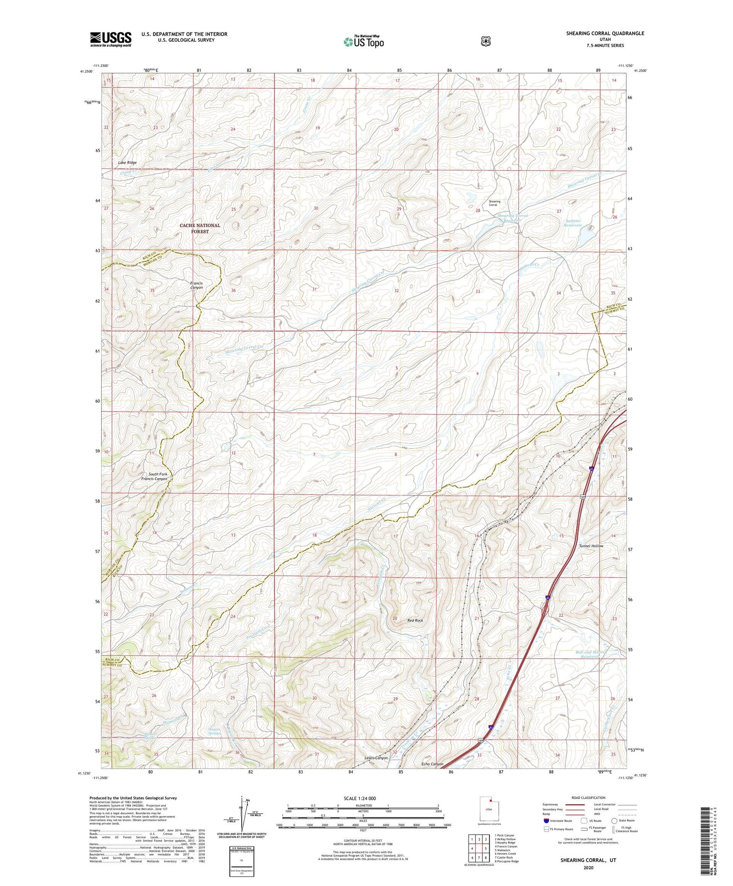
2020 topographic map quadrangle Shearing Corral in the state of Utah. Scale: 1:24000. Based on the newly updated USGS 7.5' US Topo map series, this map is in the following counties: Rich, Summit, Morgan. The map contains contour data, water features, and other items you are used to seeing on USGS maps, but also has updated roads and other features. This is the next generation of topographic maps. Printed on high-quality waterproof paper with UV fade-resistant inks.
Quads adjacent to this one:
West: Francis Canyon
Northwest: Peck Canyon
North: McKay Hollow
Northeast: Murphy Ridge
East: Wahsatch
Southeast: Porcupine Ridge
South: Castle Rock
Southwest: Heiners Creek
Contains the following named places: Ball and Moore Reservoir, Cache Cave Creek, Curvo, Dip Creek, Heiners Springs, Lake Ridge, Lewis Canyon, Red Rock, Shearing Corral, Shearing Corral Reservoir, Slaughterhouse Creek, Suttons Reservoir, Tunnel Hollow