MyTopo
Spotted Wolf Canyon Utah US Topo Map
Couldn't load pickup availability
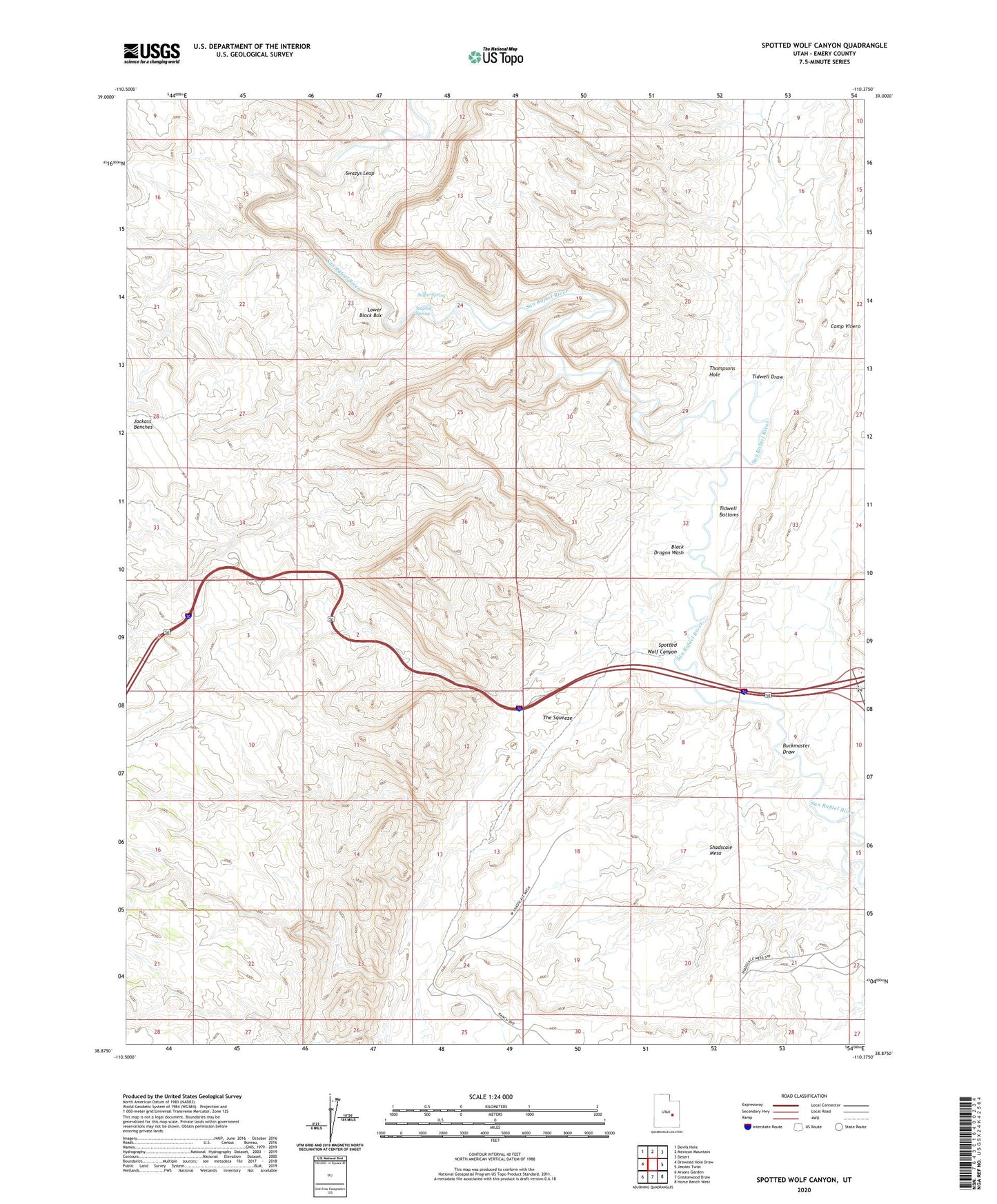
2020 topographic map quadrangle Spotted Wolf Canyon in the state of Utah. Scale: 1:24000. Based on the newly updated USGS 7.5' US Topo map series, this map is in the following counties: Emery. The map contains contour data, water features, and other items you are used to seeing on USGS maps, but also has updated roads and other features. This is the next generation of topographic maps. Printed on high-quality waterproof paper with UV fade-resistant inks.
Quads adjacent to this one:
West: Drowned Hole Draw
Northwest: Devils Hole
North: Mexican Mountain
Northeast: Desert
East: Jessies Twist
Southeast: Horse Bench West
South: Greasewood Draw
Southwest: Arsons Garden
Contains the following named places: Black Dragon Pictograph, Black Dragon Wash, Buckmaster Draw, Camp Vinero, Green River Division, Lower Black Box, Moonshine Tanks, Shadscale Mesa, Spotted Wolf Canyon, Sulfur Spring, Sulphur Spring, Swazys Leap, The Squeeze, Thompsons Hole, Tidwell Bottoms, Tidwell Draw