MyTopo
Desert Utah US Topo Map
Couldn't load pickup availability
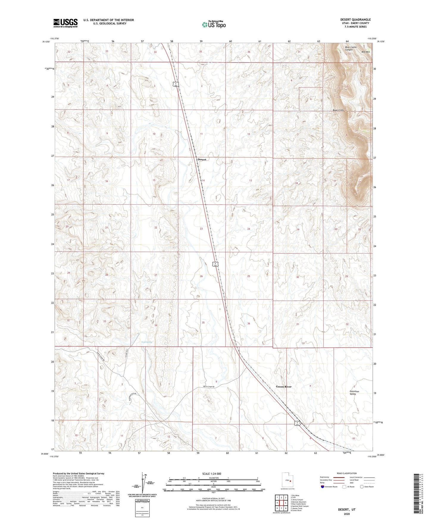
2023 topographic map quadrangle Desert in the state of Utah. Scale: 1:24000. Based on the newly updated USGS 7.5' US Topo map series, this map is in the following counties: Emery. The map contains contour data, water features, and other items you are used to seeing on USGS maps, but also has updated roads and other features. This is the next generation of topographic maps. Printed on high-quality waterproof paper with UV fade-resistant inks.
Quads adjacent to this one:
West: Mexican Mountain
Northwest: Dry Mesa
North: Cliff
Northeast: Jenny Canyon
East: Blue Castle Butte
Southeast: Green River
South: Jessies Twist
Southwest: Spotted Wolf Canyon
This map covers the same area as the classic USGS quad with code o39110a3.
Contains the following named places: Desert, Rio Grande Well, Sphinx, Trail Spring