MyTopo
Springville Utah US Topo Map
Couldn't load pickup availability
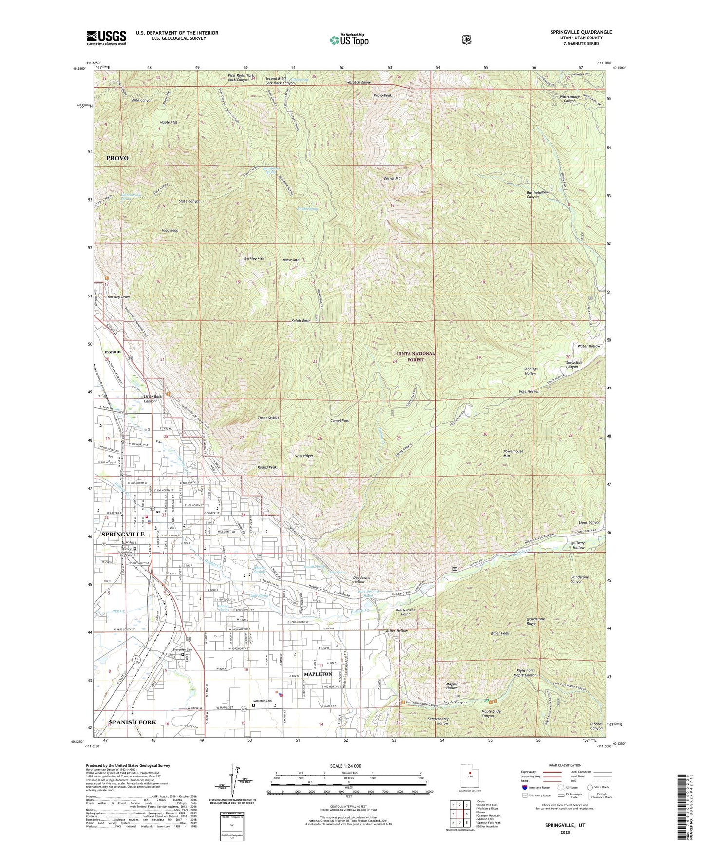
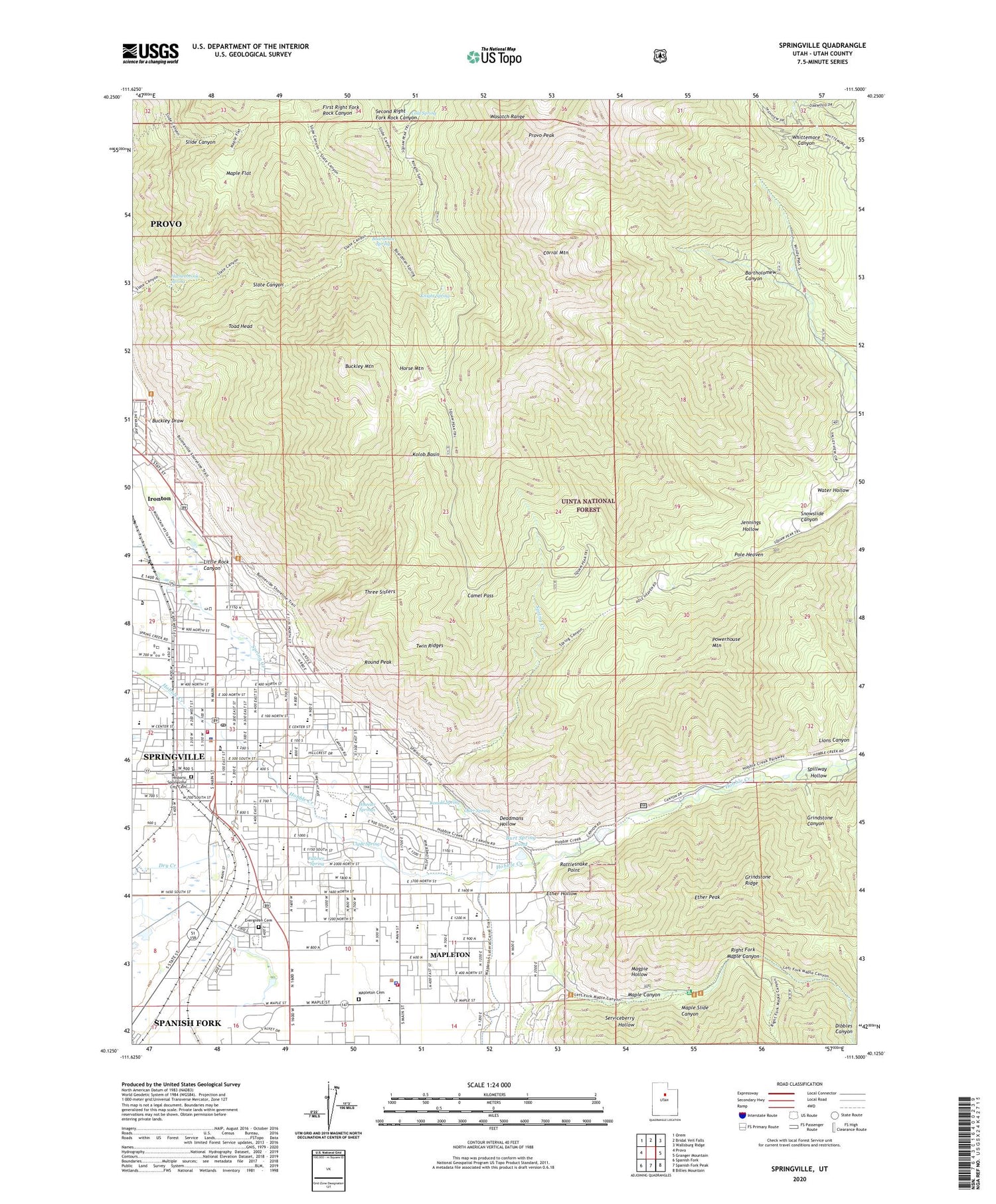
2020 topographic map quadrangle Springville in the state of Utah. Scale: 1:24000. Based on the newly updated USGS 7.5' US Topo map series, this map is in the following counties: Utah. The map contains contour data, water features, and other items you are used to seeing on USGS maps, but also has updated roads and other features. This is the next generation of topographic maps. Printed on high-quality waterproof paper with UV fade-resistant inks.
Quads adjacent to this one:
West: Provo
Northwest: Orem
North: Bridal Veil Falls
Northeast: Wallsburg Ridge
East: Granger Mountain
Southeast: Billies Mountain
South: Spanish Fork Peak
Southwest: Spanish Fork
Contains the following named places: Art City Elementary School, Boardman Spring, Brookside Elementary School, Buckley Draw, Buckley Mountain, Burt Spring Pond, Camel Pass, City of Springville, Clyde Spring, Cold Spring, Corral Mountain, Deadmans Hollow, Dibbles Canyon, Ether Hollow, Ether Peak, Evergreen Cemetery, Faith Baptist Church, Fullmer Spring, Grindstone Canyon, Grindstone Ridge, Hathenbrook Spring, Historic Springville City Cemetery, Horse Mountain, Ironton, Jefferson School, Jennings Hollow, Kellys Grove Picnic Area, Knight Spring, Kolob Basin, Kolob Basin Overlook, Konold Spring, Left Fork Hobble Creek, Legacy School, Lincoln School, Lions Canyon, Little Rock Canyon, Magpie Hollow, Maple Canyon, Maple Flat, Maple Slide Canyon, Mapleton, Mapleton Cemetery, Mapleton City Police Department, Mapleton Elementary School, Mapleton Fire Department, Osler Spring, Powerhouse Mountain, Provo Peak, Rattlesnake Point, Right Fork Hobble Creek, Right Fork Maple Canyon, Round Peak, Sage Creek Elementary School, Serviceberry Hollow, Snowslide Canyon, Spillway Hollow, Spring Creek, Springville, Springville City Police Department, Springville Community Presbyterian Church, Springville Fire and Rescue Station 41, Springville High School, Springville Junior High School, Springville Middle School, Springville Post Office, The Church of Jesus Christ of Latter Day Saints, Three Sisters, Toad Head, Twin Ridges, Wagon Wheel Trailer Park, Water Hollow, Westside Elementary School, Wheeler Springs, Whiting Camp