MyTopo
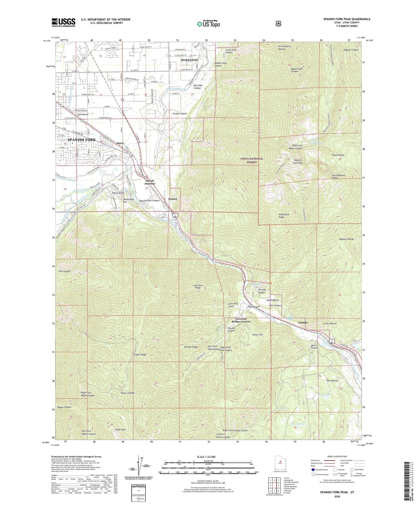
Spanish Fork Peak Utah US Topo Map
Couldn't load pickup availability
Also explore the Spanish Fork Peak Forest Service Topo of this same quad for updated USFS data
2023 topographic map quadrangle Spanish Fork Peak in the state of Utah. Scale: 1:24000. Based on the newly updated USGS 7.5' US Topo map series, this map is in the following counties: Utah. The map contains contour data, water features, and other items you are used to seeing on USGS maps, but also has updated roads and other features. This is the next generation of topographic maps. Printed on high-quality waterproof paper with UV fade-resistant inks.
Quads adjacent to this one:
West: Spanish Fork
Northwest: Provo
North: Springville
Northeast: Granger Mountain
East: Billies Mountain
Southeast: Thistle
South: Birdseye
Southwest: Payson Lakes
This map covers the same area as the classic USGS quad with code o40111a5.
Contains the following named places: Big Slide Canyon, Big Springs, Castilla, Castilla Springs, City of Mapleton, Cold Springs, Covered Bridge Canyon, Creer Hollow, Crowd Canyon, Diamond Fork, Dominguez Hill, Dream Mine, Dry Diamond Ridge, East Bench, East Bench Canal, Flat Canyon, Gomex, Green Flat, Joes Canyon, KTMP-FM (Spanish Fork), Left Fork Maple Canyon, Left Fork Pole Canyon, Left Fork Shurtz Canyon, Little Slide Canyon, Loafer Mountain Wildlife Management Area, Lone Pine Gulch, Lone Pine Ridge, Maple Canyon Lake, Mapleton Lateral, Mapleton Siding, Middle Slide Canyon, Moark Junction, North Bench, Old Spanish Mine, Pace Hollow, Pole Canyon, Power Canal, Right Fork Maple Canyon, Right Fork Pole Canyon, Right Fork Shurtz Canyon, Shurtz Canyon, Shurtz Lake, Snell Canyon, Spanish Fork Canyon, Spanish Fork Peak, Sterling Hollow, Strongs Lake, Sutro, The Church of Jesus Christ of Latter Day Saints, The Pasture, Thurber Canyon, Thurber Ridge, Wind Rock Ridge, ZIP Code: 84664