MyTopo
Tabiona Utah US Topo Map
Couldn't load pickup availability
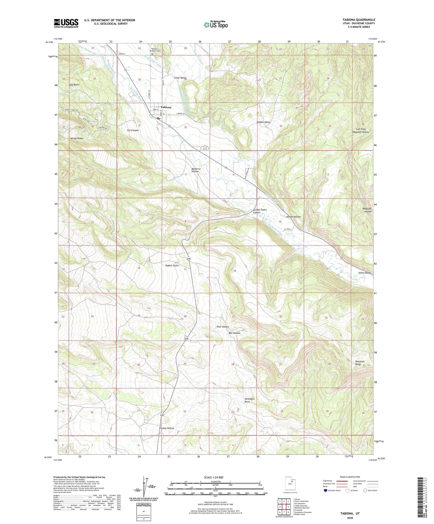
2023 topographic map quadrangle Tabiona in the state of Utah. Scale: 1:24000. Based on the newly updated USGS 7.5' US Topo map series, this map is in the following counties: Duchesne. The map contains contour data, water features, and other items you are used to seeing on USGS maps, but also has updated roads and other features. This is the next generation of topographic maps. Printed on high-quality waterproof paper with UV fade-resistant inks.
Quads adjacent to this one:
West: Tabby Mountain
Northwest: Hanna
North: Farm Creek Peak
Northeast: Dry Mountain
East: Blacktail Mountain
Southeast: Rabbit Gulch
South: Strawberry Pinnacles
Southwest: Fruitland
This map covers the same area as the classic USGS quad with code o40110c6.
Contains the following named places: Barberra Hollow, Blacktail Ridge, Bridger Ditch, Cat Canyon, Cockey Hollow, Golden Stairs Canyon, Hicken Ditch, Hicken Hollow, Hidden Valley, Hidden Valley Canal, Jasper Pike Canal, Jepp Basin, Jepp Thomas Canal, Left Fork Wagstaff Hollow, Little Valley, Mill Hollow, Red Creek Wildlife Management Area, Santaquin Draw, Tabby Canal, Tabiona, Tabiona - Redcliff Cemetery, Tabiona Fire Department, Tabiona High School, Tabiona Post Office, The Church of Jesus Christ of Latter Day Saints, Town of Tabiona, Trail Hollow, Wagstaff Hollow, Windy Ridge, ZIP Code: 84072