MyTopo
Three Fords Canyon Utah US Topo Map
Couldn't load pickup availability
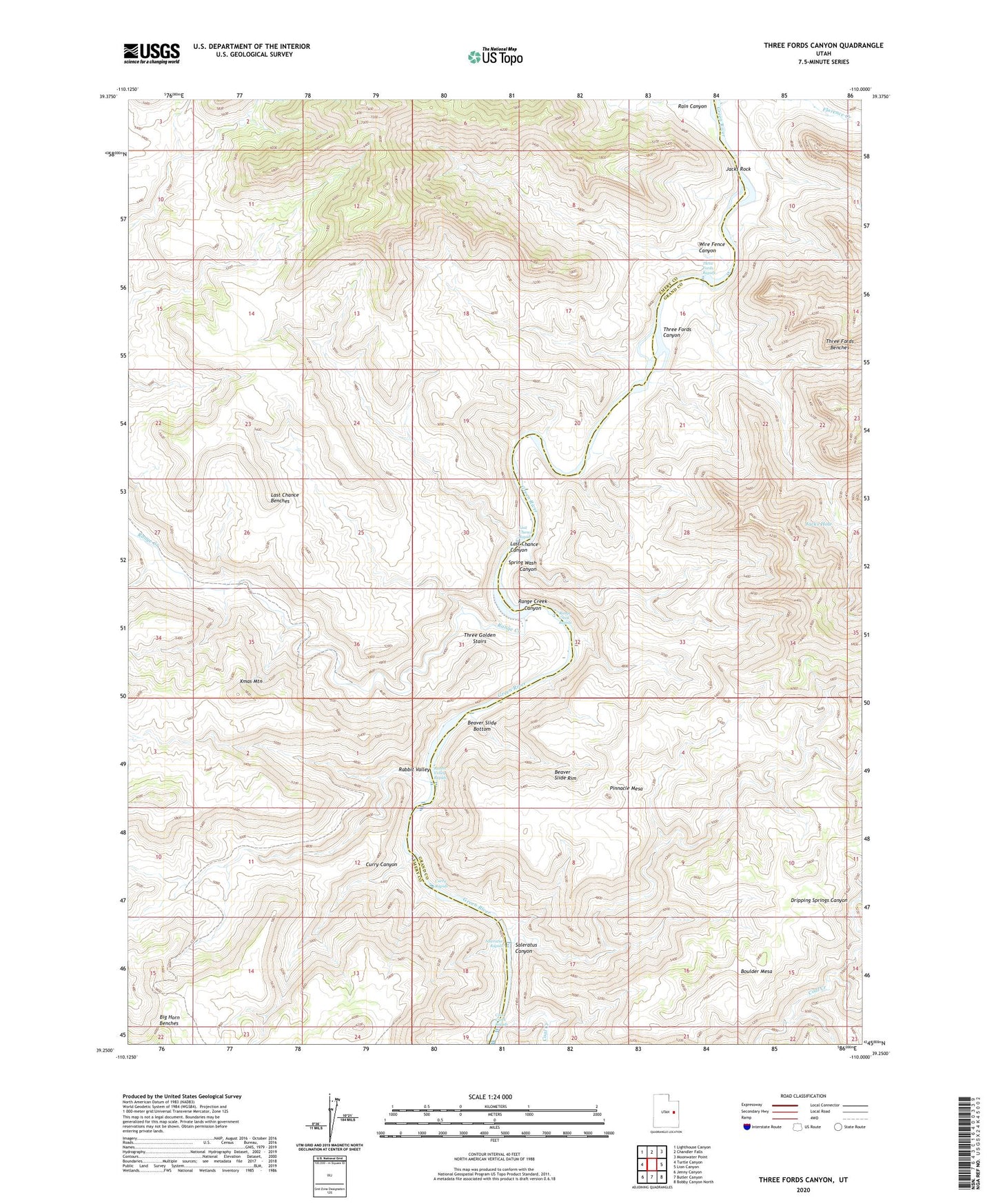
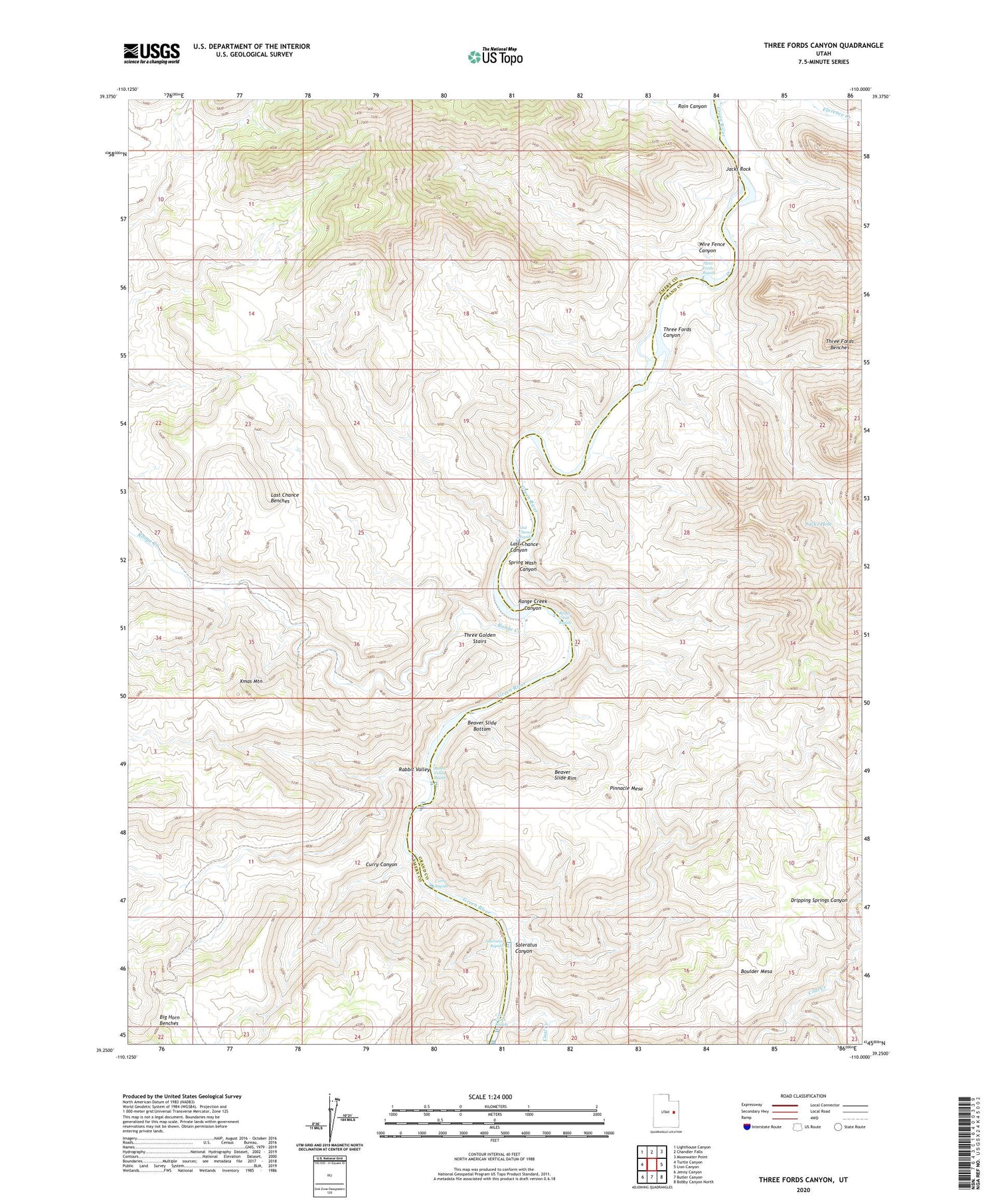
2020 topographic map quadrangle Three Fords Canyon in the state of Utah. Scale: 1:24000. Based on the newly updated USGS 7.5' US Topo map series, this map is in the following counties: Emery, Grand. The map contains contour data, water features, and other items you are used to seeing on USGS maps, but also has updated roads and other features. This is the next generation of topographic maps. Printed on high-quality waterproof paper with UV fade-resistant inks.
Quads adjacent to this one:
West: Turtle Canyon
Northwest: Lighthouse Canyon
North: Chandler Falls
Northeast: Moonwater Point
East: Lion Canyon
Southeast: Bobby Canyon North
South: Butler Canyon
Southwest: Jenny Canyon
Contains the following named places: Beaver Slide Bottom, Beaver Slide Rim, Boulder Mesa, Coal Creek, Coal Creek Rapids, Curry Canyon, Curry Rapids, Florence Creek, Jacks Hole, Jacks Rock, Last Chance Benches, Last Chance Canyon, Last Chance Rapids, Pinnacle Mesa, Rabbit Valley, Rabbit Valley Rapids, Rain Canyon, Range Creek, Range Creek Canyon, Range Creek Rapids, Saleratus Canyon, Saleratus Rapids, Spring Wash Canyon, Three Fords Benches, Three Fords Canyon, Three Fords Rapids, Three Golden Stairs, Wire Fence Canyon, Xmas Mountain