MyTopo
Trenton Utah US Topo Map
Couldn't load pickup availability
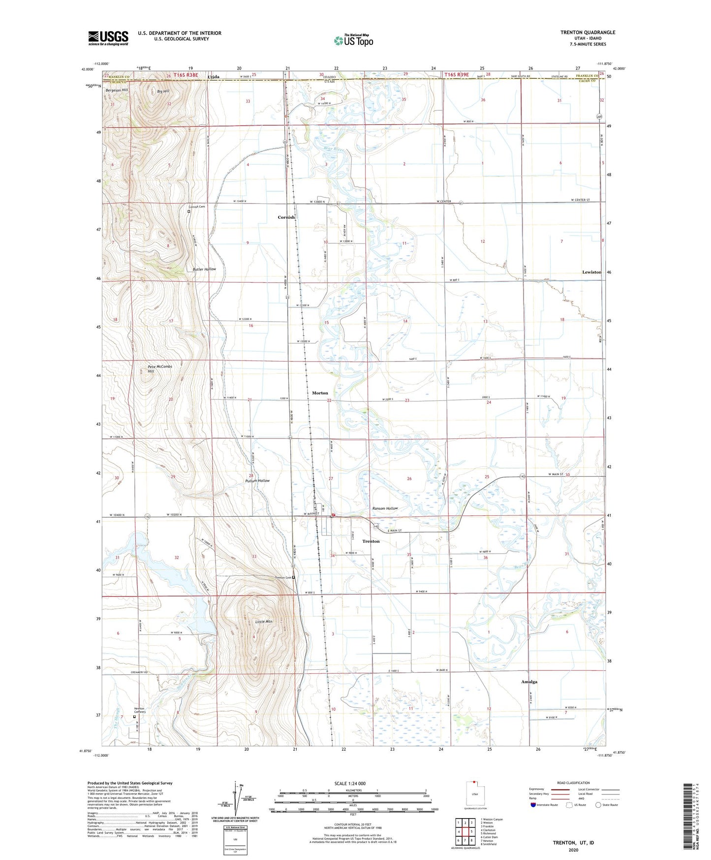
2023 topographic map quadrangle Trenton in the state of Utah. Scale: 1:24000. Based on the newly updated USGS 7.5' US Topo map series, this map is in the following counties: Cache, Franklin. The map contains contour data, water features, and other items you are used to seeing on USGS maps, but also has updated roads and other features. This is the next generation of topographic maps. Printed on high-quality waterproof paper with UV fade-resistant inks.
Quads adjacent to this one:
West: Clarkston
Northwest: Weston Canyon
North: Weston
Northeast: Franklin
East: Richmond
Southeast: Smithfield
South: Newton
Southwest: Cutler Dam
This map covers the same area as the classic USGS quad with code o41111h8.
Contains the following named places: Amalga Branch West Cache Canal, Big Hill, Butler Hollow, City of Lewiston, Cornish, Cornish Cemetery, Cottle, Cub River, Lewiston Division, Little Mountain, Morton, Newton Branch West Cache Canal, Newton Cemeery, Newton Dam, Newton Reservoir, Pete McCombs Hill, Pullum Hollow, Ransom Hollow, Southwest Lewiston Canal, The Church of Jesus Christ of Latter Day Saints, Town of Cornish, Town of Trenton, Trenton, Trenton Cemetery, Trenton City Fire Department, Trenton Post Office, Utida, West Cache Canal, West Pump Canal, ZIP Code: 84338