MyTopo
Franklin Idaho US Topo Map
Couldn't load pickup availability
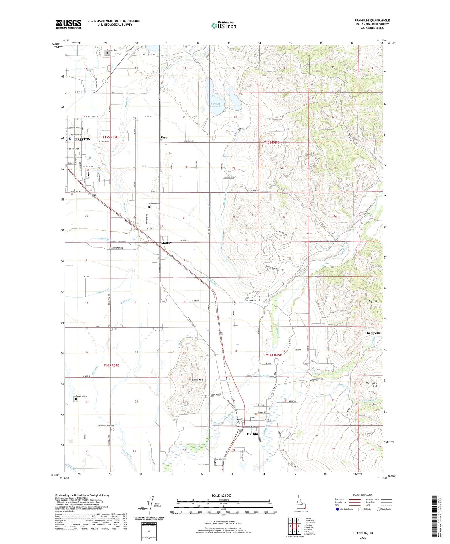
2023 topographic map quadrangle Franklin in the state of Idaho. Scale: 1:24000. Based on the newly updated USGS 7.5' US Topo map series, this map is in the following counties: Franklin. The map contains contour data, water features, and other items you are used to seeing on USGS maps, but also has updated roads and other features. This is the next generation of topographic maps. Printed on high-quality waterproof paper with UV fade-resistant inks.
Quads adjacent to this one:
West: Weston
Northwest: Banida
North: Riverdale
Northeast: Mink Creek
East: Mapleton
Southeast: Naomi Peak
South: Richmond
Southwest: Trenton
This map covers the same area as the classic USGS quad with code o42111a7.
Contains the following named places: Big Hill, Central School, City of Franklin, Cub Canal, Deep Creek, Egypt, Fairview Cemetery, Foster Dam, Foster Reservoir Access Area, Franklin, Franklin Cemetery, Franklin County Medical Center, Franklin Post Office, Hinkley Dam, Jefferson Junior High School, Jefferson School, Johnson Dam, Johnson Reservoir, Lamont Dam, Lamont Reservoir, Le Fevre Dam, Little Mountain, Maple Creek, Middle Ditch, Nashville, Oakwood Elementary School, Pioneer Elementary School, Preston Cemetery, Preston High School, Van Orden Dam, Whitney, Whitney Cemetery, Whitney School, ZIP Code: 83237