
MyTopo
Twin Hollow Utah US Topo Map
Couldn't load pickup availability
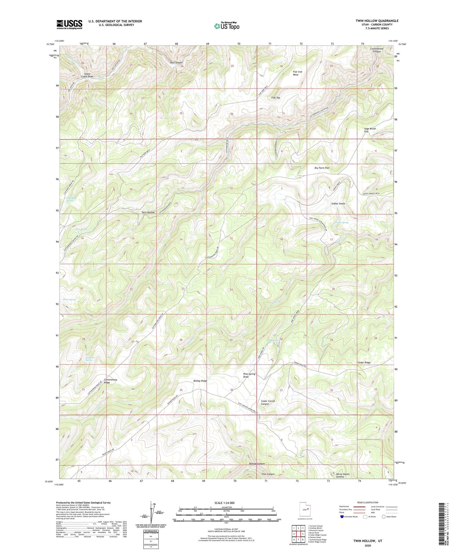
2020 topographic map quadrangle Twin Hollow in the state of Utah. Scale: 1:24000. Based on the newly updated USGS 7.5' US Topo map series, this map is in the following counties: Carbon. The map contains contour data, water features, and other items you are used to seeing on USGS maps, but also has updated roads and other features. This is the next generation of topographic maps. Printed on high-quality waterproof paper with UV fade-resistant inks.
Quads adjacent to this one:
West: Bruin Point
Northwest: Currant Canyon
North: Cowboy Bench
Northeast: Pinnacle Canyon
East: Cedar Ridge Canyon
Southeast: Steer Ridge Canyon
South: Summerhouse Ridge
Southwest: Patmos Head
Contains the following named places: Bishop Canyon, Bishop Ridge, Buckhorn Spring, Clay Bank Spring, Cottonwood Ridge, Dry Farm Flat, Elbow Spring, Flat Iron Mesa, Flat Top, Horse Haven Summit, Indian Spring, Indian Swale, Petes Spring, Pine Spring, Sage Brush Flat, Stone Cabin Creek, Stone Cabin Draw, Twin Hollow


