MyTopo
Twin Peaks Utah US Topo Map
Couldn't load pickup availability
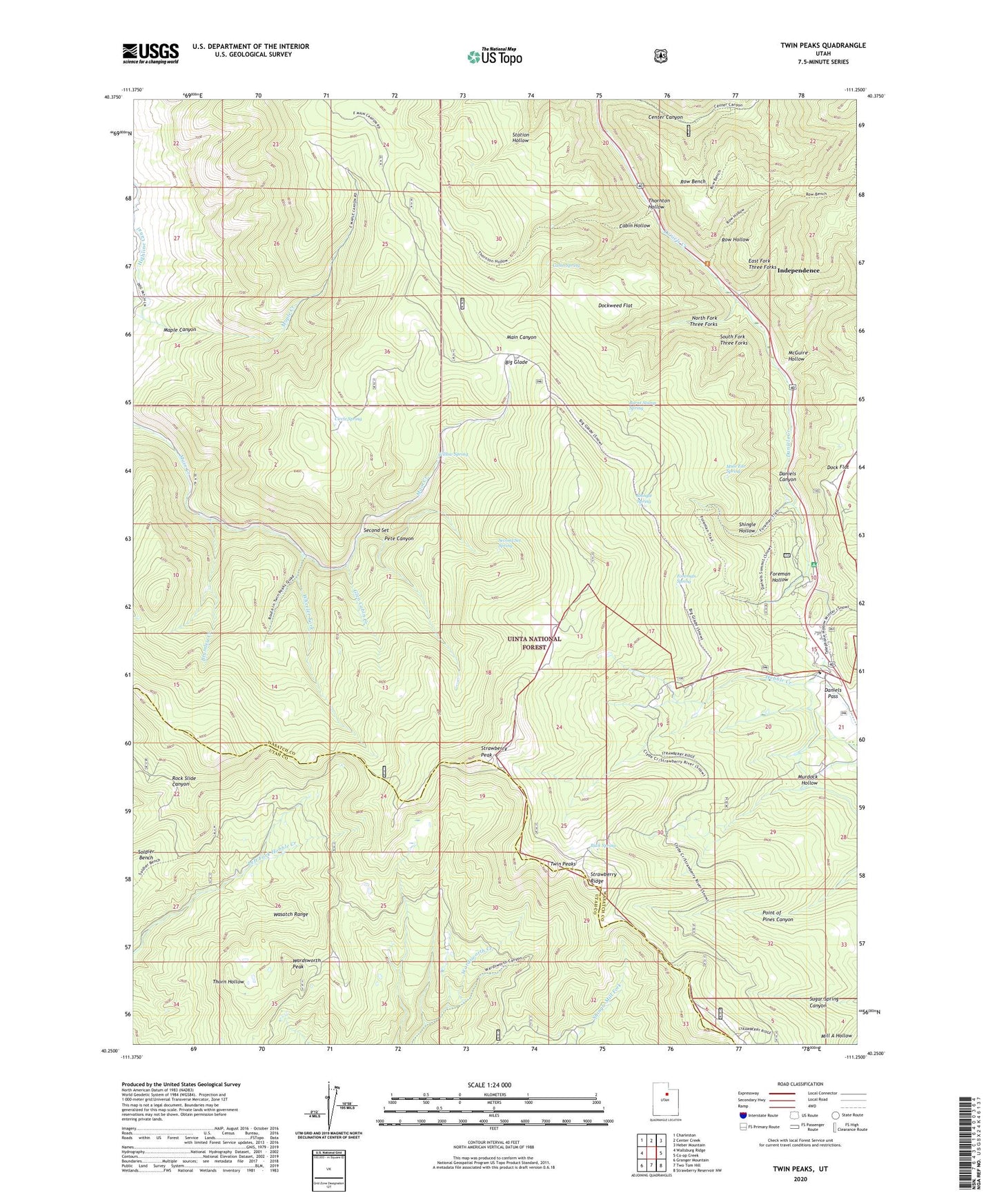
2020 topographic map quadrangle Twin Peaks in the state of Utah. Scale: 1:24000. Based on the newly updated USGS 7.5' US Topo map series, this map is in the following counties: Wasatch, Utah. The map contains contour data, water features, and other items you are used to seeing on USGS maps, but also has updated roads and other features. This is the next generation of topographic maps. Printed on high-quality waterproof paper with UV fade-resistant inks.
Quads adjacent to this one:
West: Wallsburg Ridge
Northwest: Charleston
North: Center Creek
Northeast: Heber Mountain
East: Co-op Creek
Southeast: Strawberry Reservoir NW
South: Two Tom Hill
Southwest: Granger Mountain
Contains the following named places: Big Glade, Brumley Creek, Buck Spring, Burnt Stump Spring, Cabin Hollow, Cabin Spring, Circle Spring, Daniels Pass, Dock Flat, Dockweed Flat, East Fork Three Forks, Foreman Hollow, Foreman Spring, Glen Cabin Creek, Harris Reservoir, Highline Canal, Independence, Lodge Pole Campground, Maple Canyon, McGuire Hollow, Mule Ear Spring, Murdock Hollow, North Fork Three Forks, Pete Canyon, Row Bench, Row Hollow, Second Set, Second Set Spring, Shingle Hollow, Shingle Spring, South Fork Three Forks, Strawberry Peak, Strawberry Ridge, Thornton Hollow, Twin Peaks, Wardsworth Peak, Wheeler Fork, Willow Spring