MyTopo
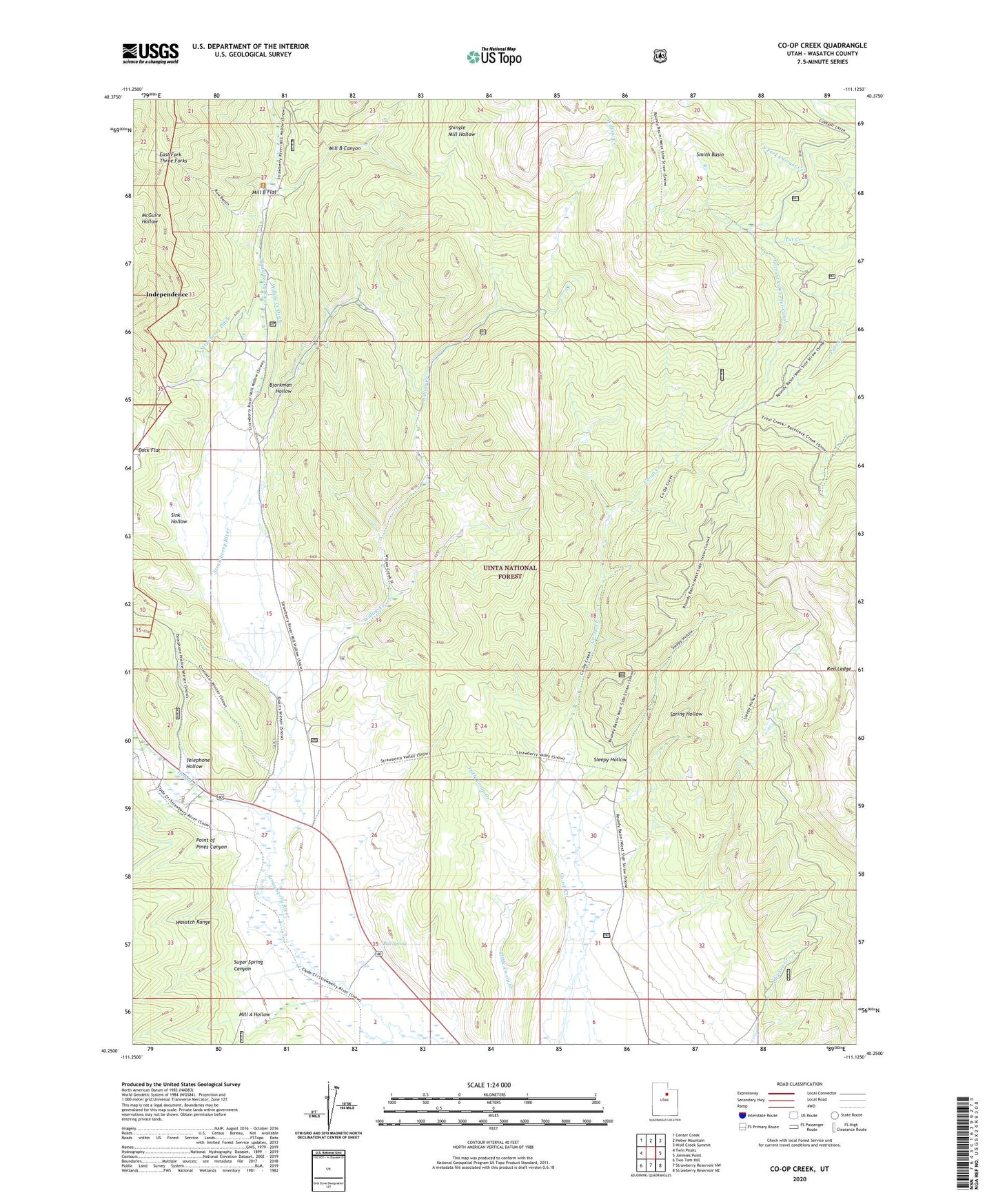
Co-op Creek Utah US Topo Map
Couldn't load pickup availability
Also explore the Co-op Creek Forest Service Topo of this same quad for updated USFS data
2023 topographic map quadrangle Co-op Creek in the state of Utah. Scale: 1:24000. Based on the newly updated USGS 7.5' US Topo map series, this map is in the following counties: Wasatch. The map contains contour data, water features, and other items you are used to seeing on USGS maps, but also has updated roads and other features. This is the next generation of topographic maps. Printed on high-quality waterproof paper with UV fade-resistant inks.
Quads adjacent to this one:
West: Twin Peaks
Northwest: Center Creek
North: Heber Mountain
Northeast: Wolf Creek Summit
East: Jimmies Point
Southeast: Strawberry Reservoir NE
South: Strawberry Reservoir NW
Southwest: Two Tom Hill
This map covers the same area as the classic USGS quad with code o40111c2.
Contains the following named places: Bjorkman Hollow, Bull Spring, Currant Creek Feeder Canal, Hobble Creek, Hub Guard Station, Mill A Hollow, Mill B Canyon, Mill B Flat, Point of Pines Canyon, Red Ledge, Shingle Mill Hollow, Sink Hollow, Sleepy Hollow, Smith Basin, Spring Hollow, Strawberry Ditch, Sugar Spring Canyon, Telephone Hollow, Wasatch County, Willow Creek, Willow Creek Ditch