MyTopo
Strawberry Reservoir NW Utah US Topo Map
Couldn't load pickup availability
Also explore the Strawberry Reservoir NW Forest Service Topo of this same quad for updated USFS data
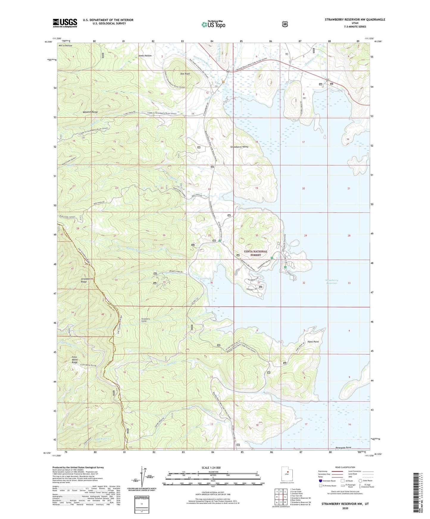
2023 topographic map quadrangle Strawberry Reservoir NW in the state of Utah. Scale: 1:24000. Based on the newly updated USGS 7.5' US Topo map series, this map is in the following counties: Wasatch, Utah. The map contains contour data, water features, and other items you are used to seeing on USGS maps, but also has updated roads and other features. This is the next generation of topographic maps. Printed on high-quality waterproof paper with UV fade-resistant inks.
Quads adjacent to this one:
West: Two Tom Hill
Northwest: Twin Peaks
North: Co-op Creek
Northeast: Jimmies Point
East: Strawberry Reservoir NE
Southeast: Strawberry Reservoir SE
South: Strawberry Reservoir SW
Southwest: Rays Valley
This map covers the same area as the classic USGS quad with code o40111b2.
Contains the following named places: Bryants Fork, Bryants Fork Campground, Bryants Fork Guard Station, Bryants Fork Summer Home Area, Camp Strawberry, Chaplain Point Day Use Area, Chaplain Point Fisherman Access, Chicken Creek, Chicken Creek Day Use Area, Clarks Camp, Clyde Creek, Co-op Creek, Doe Knoll, East Portal, Haws Point, Haws Point Day Use Area, Horse Creek, Indian Bay Dike, Indian Creek Diversion Canal, Jones Hollow, Little Co-op Creek, Midview Dam, Mud Creek, Mud Creek Fisherman Access, Rocky Mountain Helicopters Incorporated Heliport, Strawberry Administrative Site, Strawberry Bay Campground, Strawberry Bay Recreation Complex, Strawberry Reservoir, Strawberry Tunnel, Strawberry Valley