MyTopo
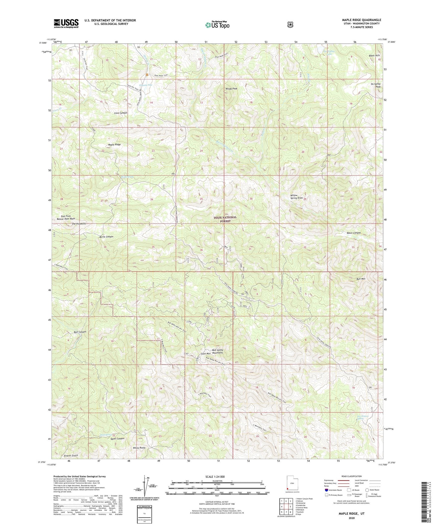
Maple Ridge Utah US Topo Map
Couldn't load pickup availability
Also explore the Maple Ridge Forest Service Topo of this same quad for updated USFS data
2023 topographic map quadrangle Maple Ridge in the state of Utah. Scale: 1:24000. Based on the newly updated USGS 7.5' US Topo map series, this map is in the following counties: Washington. The map contains contour data, water features, and other items you are used to seeing on USGS maps, but also has updated roads and other features. This is the next generation of topographic maps. Printed on high-quality waterproof paper with UV fade-resistant inks.
Quads adjacent to this one:
West: Goldstrike
Northwest: Water Canyon Peak
North: Hebron
Northeast: Enterprise
East: Central West
Southeast: Veyo
South: Gunlock
Southwest: Motoqua
This map covers the same area as the classic USGS quad with code o37113d7.
Contains the following named places: Black Hills, Bull Canyon, Bull Mountain, Burnt Canyon, Cove Mountain, Doc Watson Spring, Grassy Flat, Maple Ridge, Maple Spring, Ox Valley Lake, Ox Valley Peak, Pilot Creek, Quail Spring, Racer Canyon, Racer Canyon Creek, South Boundary Trail, The Pinnacles, White Rocks, Willow Spring Draw, Windy Peak