MyTopo
Wahsatch Utah US Topo Map
Couldn't load pickup availability
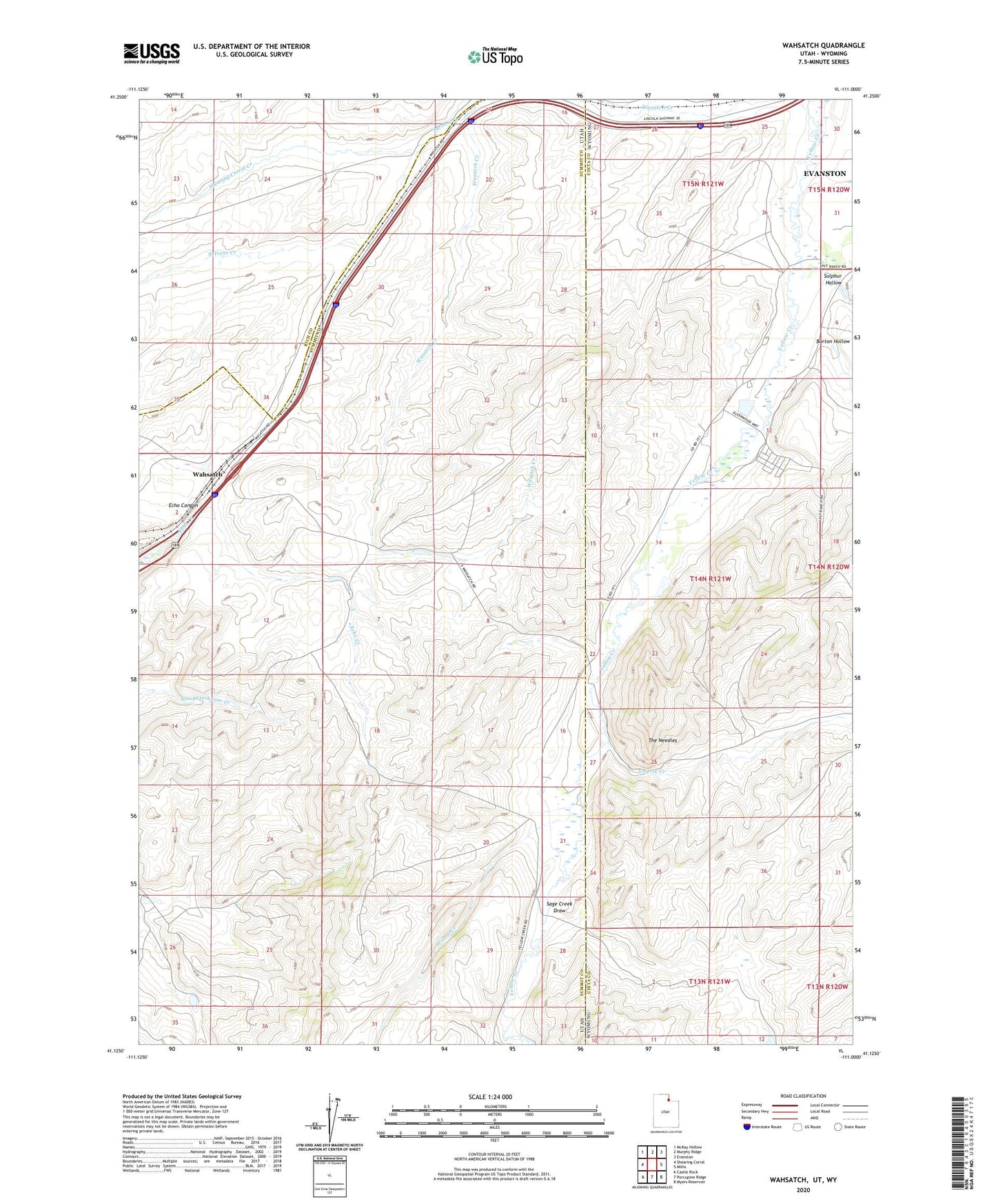
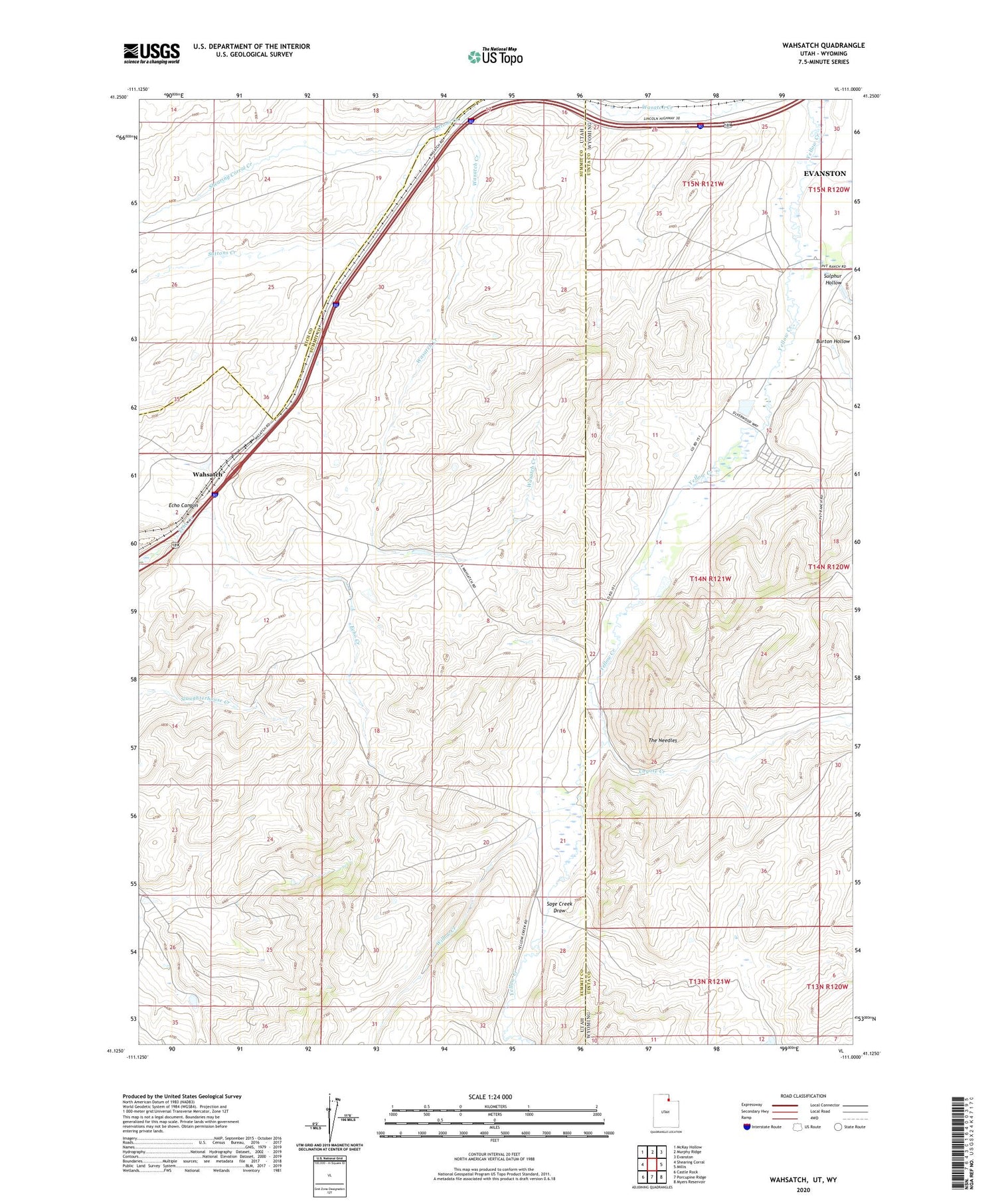
2020 topographic map quadrangle Wahsatch in the states of Utah, Wyoming. Scale: 1:24000. Based on the newly updated USGS 7.5' US Topo map series, this map is in the following counties: Summit, Uinta, Rich. The map contains contour data, water features, and other items you are used to seeing on USGS maps, but also has updated roads and other features. This is the next generation of topographic maps. Printed on high-quality waterproof paper with UV fade-resistant inks.
Quads adjacent to this one:
West: Shearing Corral
Northwest: McKay Hollow
North: Murphy Ridge
Northeast: Evanston
East: Millis
Southeast: Myers Reservoir
South: Porcupine Ridge
Southwest: Castle Rock
Contains the following named places: Burton Hollow, Coyote Creek, Emigrant Trail, Pony Express and Overland Stage Route, Sage Creek, Sage Creek Draw, Shearing Corral Creek, Sulphur Hollow, Suttons Creek, The Needles, Utah and Wyoming Port of Entry Stations, Wahsatch, Willow Creek