MyTopo
Millis Wyoming US Topo Map
Couldn't load pickup availability
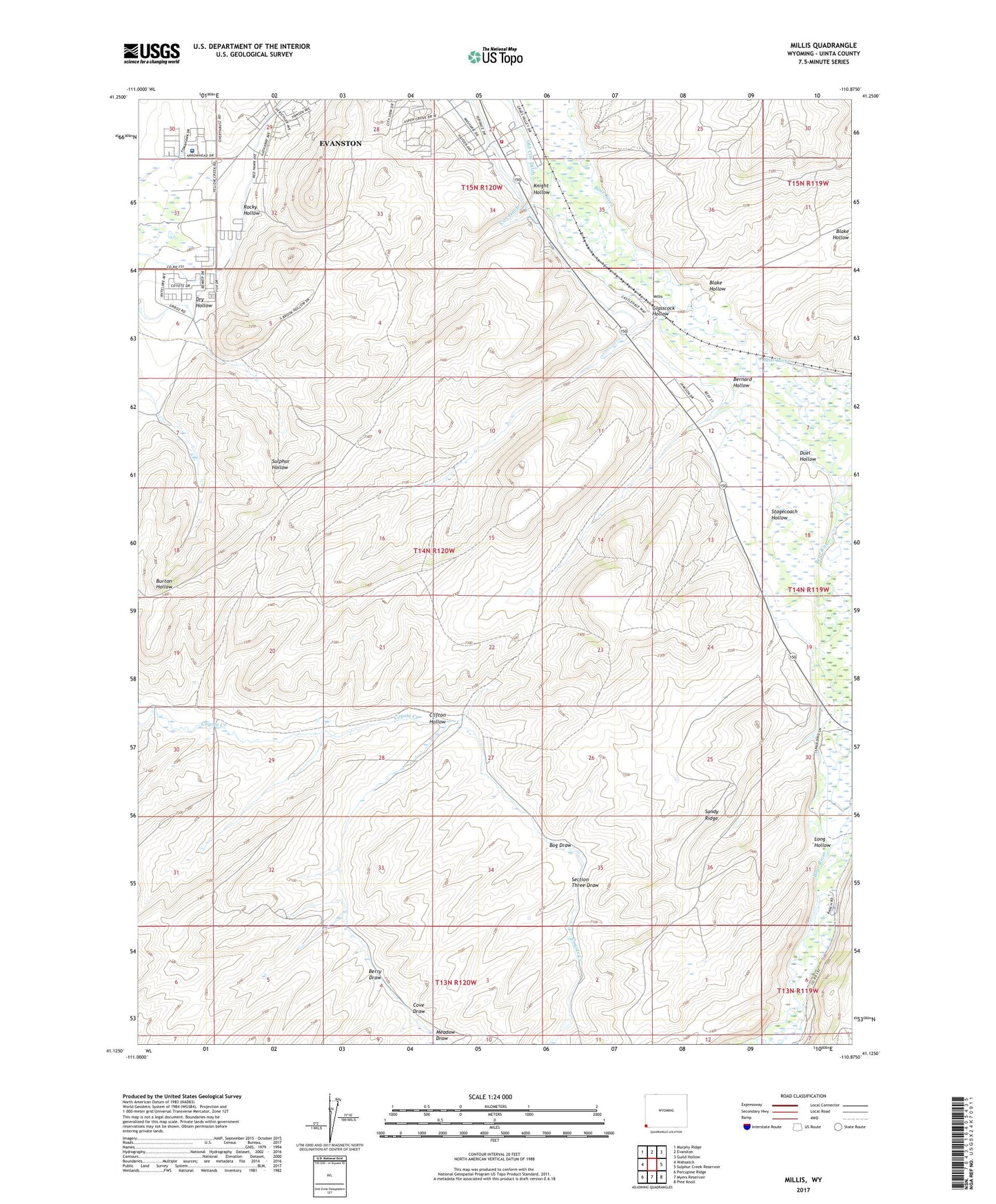
2021 topographic map quadrangle Millis in the state of Wyoming. Scale: 1:24000. Based on the newly updated USGS 7.5' US Topo map series, this map is in the following counties: Uinta. The map contains contour data, water features, and other items you are used to seeing on USGS maps, but also has updated roads and other features. This is the next generation of topographic maps. Printed on high-quality waterproof paper with UV fade-resistant inks.
Quads adjacent to this one:
West: Wahsatch
Northwest: Murphy Ridge
North: Evanston
Northeast: Guild Hollow
East: Sulphur Creek Reservoir
Southeast: Pine Knoll
South: Myers Reservoir
Southwest: Porcupine Ridge
This map covers the same area as the classic USGS quad with code o41110b8.
Contains the following named places: Bernard Hollow, Berry Draw, Blake Hollow, Bog Draw, Clifton Hollow, Cove Draw, Dry Hollow, Duel Hollow, East Dam, East Reservoir, Emigrant Trail, Evanston Pumping Station, Evanston Regional Hospital, Glasscock Hollow, Jamison Claim, Knight Hollow, Long Hollow, Meadow Draw, Rocky Hollow, Sandy Ridge, Section Three Draw, Spring Creek, Stagecoach Hollow, Stowe Creek, Uinta County Fire Protection Evanston Station 3