MyTopo
Wallaces Peak Utah US Topo Map
Couldn't load pickup availability
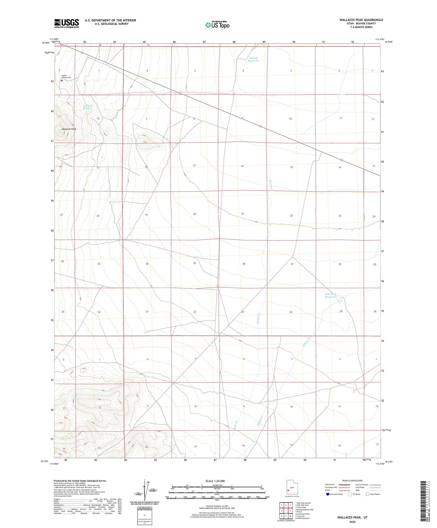
2020 topographic map quadrangle Wallaces Peak in the state of Utah. Scale: 1:24000. Based on the newly updated USGS 7.5' US Topo map series, this map is in the following counties: Beaver. The map contains contour data, water features, and other items you are used to seeing on USGS maps, but also has updated roads and other features. This is the next generation of topographic maps. Printed on high-quality waterproof paper with UV fade-resistant inks.
Quads adjacent to this one:
West: Sewing Machine Pass
Northwest: Wah Wah Summit
North: Wah Wah Cove
Northeast: Frisco Peak
East: Frisco
Southeast: White Mountain
South: Frisco SW
Southwest: Lamerdorf Peak
Contains the following named places: Quartz Creek, Squire Family Cemetery, Wah Wah Ranch, Wah Wah Reservoir, Wah Wah Springs, Wallaces Peak, Willow Creek, Wintch Dam, Wintch Reservoir