MyTopo
Frisco Peak Utah US Topo Map
Couldn't load pickup availability
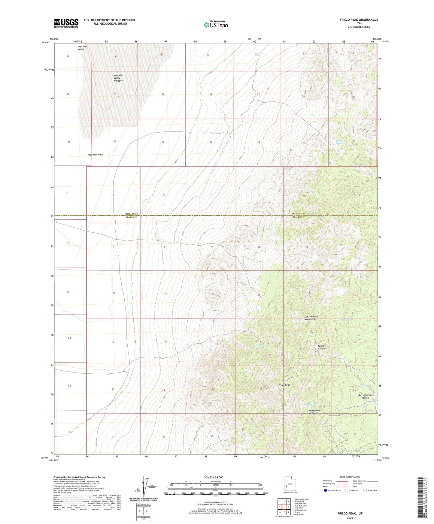
2023 topographic map quadrangle Frisco Peak in the state of Utah. Scale: 1:24000. Based on the newly updated USGS 7.5' US Topo map series, this map is in the following counties: Beaver, Millard. The map contains contour data, water features, and other items you are used to seeing on USGS maps, but also has updated roads and other features. This is the next generation of topographic maps. Printed on high-quality waterproof paper with UV fade-resistant inks.
Quads adjacent to this one:
West: Wah Wah Cove
Northwest: Fifteenmile Point
North: Brown Knoll
Northeast: Iron Mine Pass
East: High Rock
Southeast: Milford NW
South: Frisco
Southwest: Wallaces Peak
This map covers the same area as the classic USGS quad with code o38113e3.
Contains the following named places: Barrel Spring Canyon, Crystal Spring, Frisco Peak, Golden Reef Mine, Horse Spring, Indian Queen Mine, Indian Queen Reservoir, Morehouse Spring, Pitchforth Spring, San Francisco Mountains, Tow Rock Charcoal Kilns, Tub Spring, Two Rock Charcoal Kilns, Wah Wah Wash