MyTopo
Westwater Utah US Topo Map
Couldn't load pickup availability
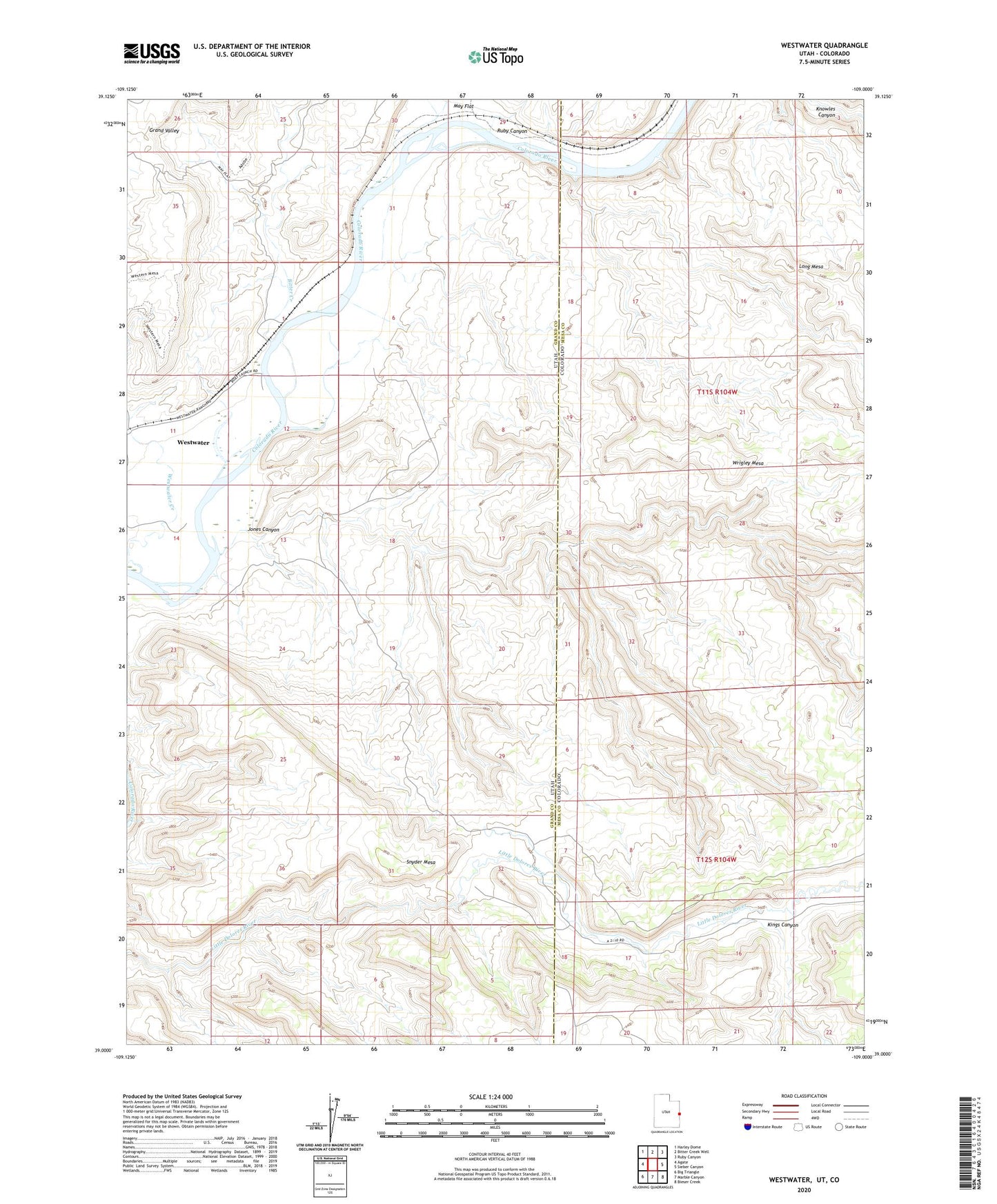
2023 topographic map quadrangle Westwater in the states of Utah, Colorado. Scale: 1:24000. Based on the newly updated USGS 7.5' US Topo map series, this map is in the following counties: Grand, Mesa. The map contains contour data, water features, and other items you are used to seeing on USGS maps, but also has updated roads and other features. This is the next generation of topographic maps. Printed on high-quality waterproof paper with UV fade-resistant inks.
Quads adjacent to this one:
West: Agate
Northwest: Harley Dome
North: Bitter Creek Well
Northeast: Ruby Canyon
East: Sieber Canyon
Southeast: Bieser Creek
South: Marble Canyon
Southwest: Big Triangle
This map covers the same area as the classic USGS quad with code o39109a1.
Contains the following named places: Bitter Creek, Jones Canyon, Kings Canyon, Little Dolores River, Ruby Canyon, Snyder Mesa, Westwater, Westwater River Ranger Station and Put In Site, Wrigley Mesa