MyTopo
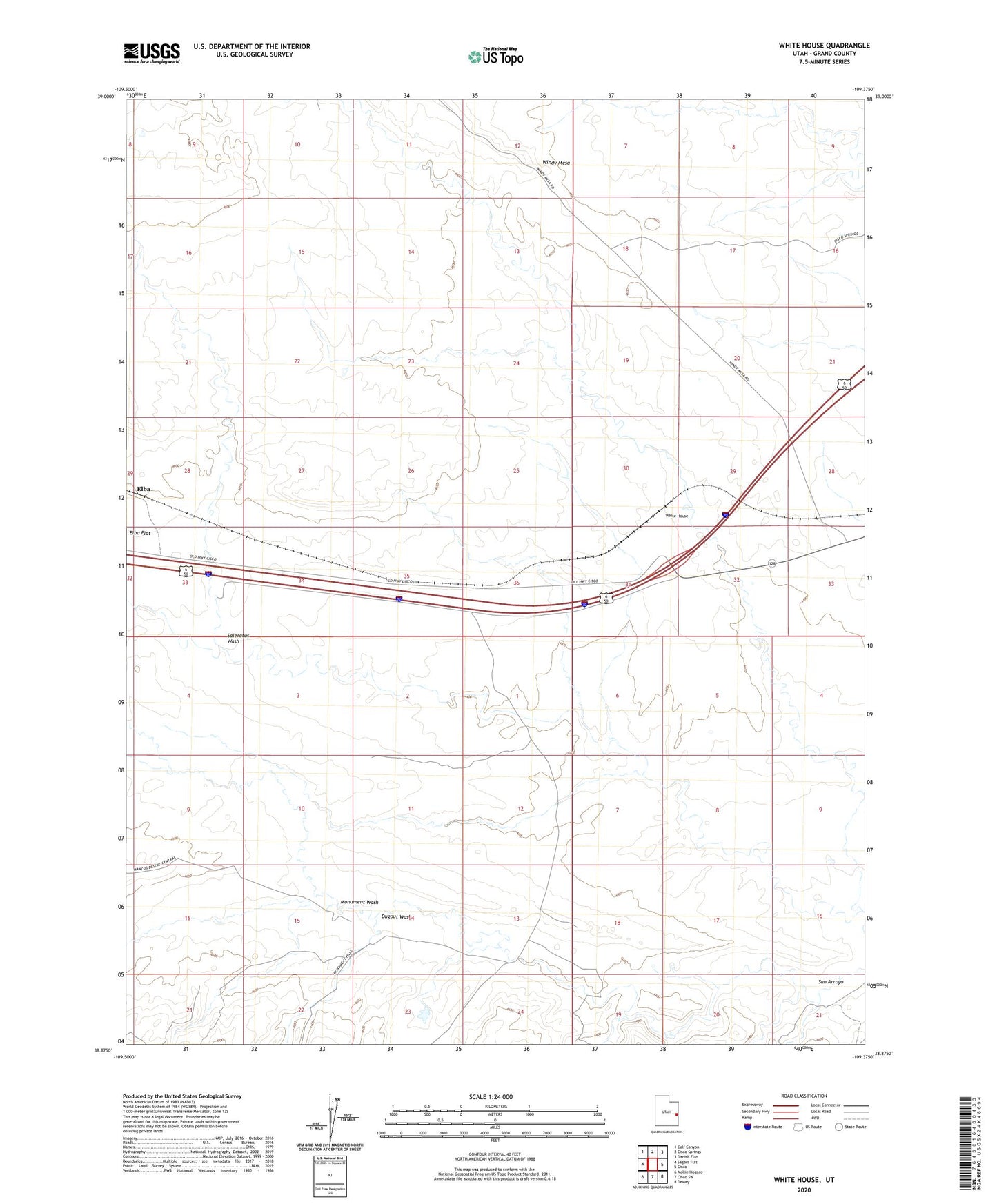
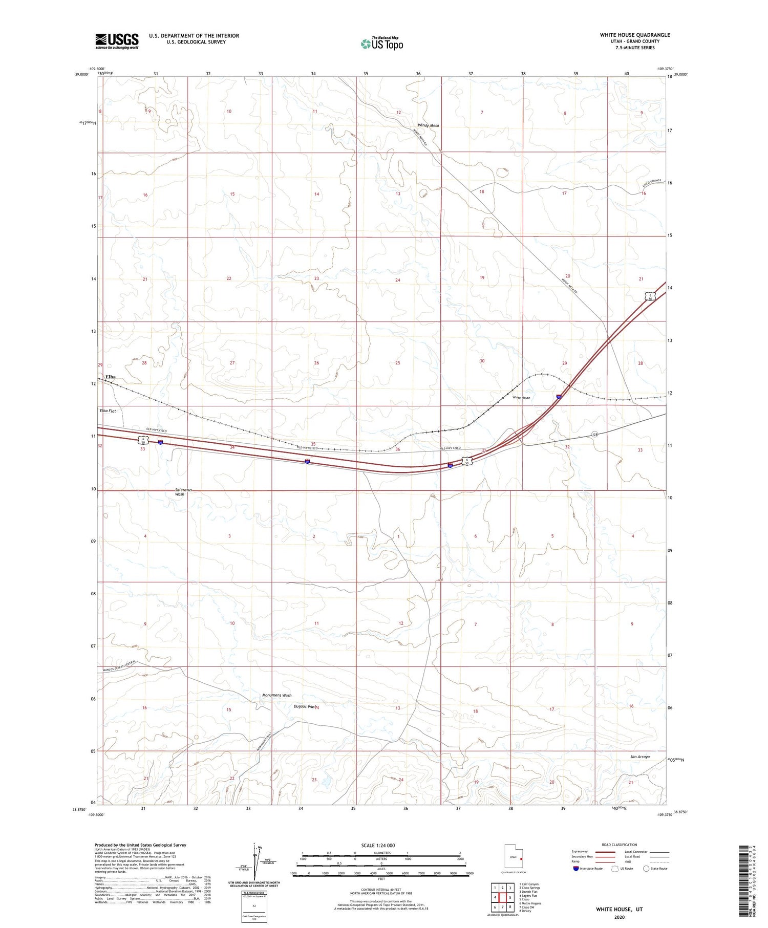
White House Utah US Topo Map
Couldn't load pickup availability
2020 topographic map quadrangle White House in the state of Utah. Scale: 1:24000. Based on the newly updated USGS 7.5' US Topo map series, this map is in the following counties: Grand. The map contains contour data, water features, and other items you are used to seeing on USGS maps, but also has updated roads and other features. This is the next generation of topographic maps. Printed on high-quality waterproof paper with UV fade-resistant inks.
Quads adjacent to this one:
West: Sagers Flat
Northwest: Calf Canyon
North: Cisco Springs
Northeast: Danish Flat
East: Cisco
Southeast: Dewey
South: Cisco SW
Southwest: Mollie Hogans
Contains the following named places: Dugout Wash, Monument Wash, Saleratus Wash, San Arroyo, White House, Windy Mesa