MyTopo
Cisco Springs Utah US Topo Map
Couldn't load pickup availability
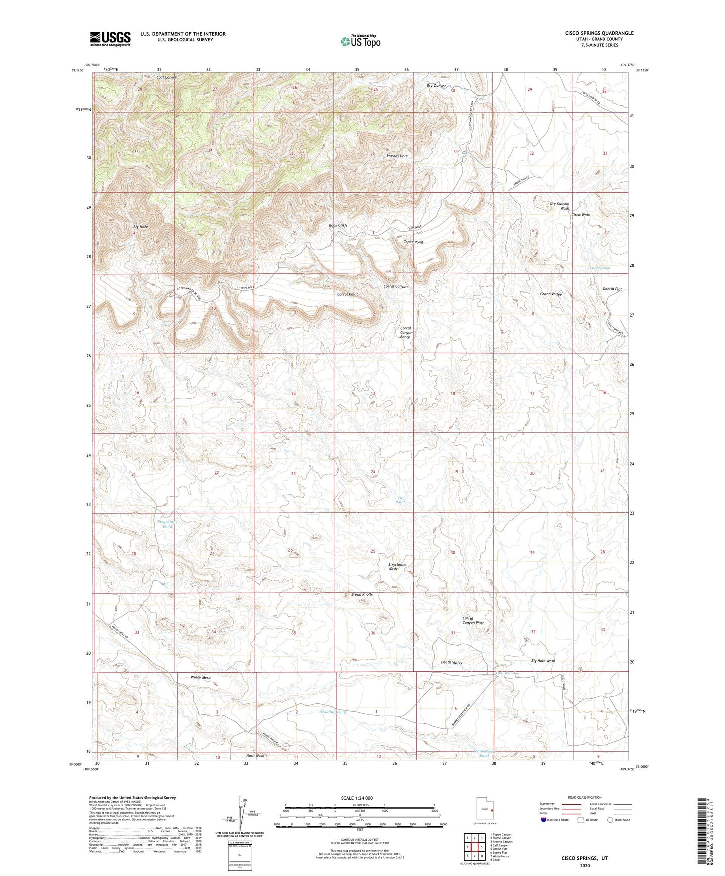
2023 topographic map quadrangle Cisco Springs in the state of Utah. Scale: 1:24000. Based on the newly updated USGS 7.5' US Topo map series, this map is in the following counties: Grand. The map contains contour data, water features, and other items you are used to seeing on USGS maps, but also has updated roads and other features. This is the next generation of topographic maps. Printed on high-quality waterproof paper with UV fade-resistant inks.
Quads adjacent to this one:
West: Calf Canyon
Northwest: Tepee Canyon
North: Flume Canyon
Northeast: Antone Canyon
East: Danish Flat
Southeast: Cisco
South: White House
Southwest: Sagers Flat
This map covers the same area as the classic USGS quad with code o39109a4.
Contains the following named places: Big Hole, Big Hole Wash, Bread Knolls, Cisco Springs, Corral Canyon, Corral Canyon Bench, Corral Canyon Wash, Corral Point, Dead Sheep Pond, Death Valley, Dry Canyon, Dry Canyon Wash, Holding Pond, Strychnine Pond, Strychnine Wash, Swedes Hole, Tepee Point, Tie Pond, Twin Pond