MyTopo
Bridport Vermont US Topo Map
Couldn't load pickup availability
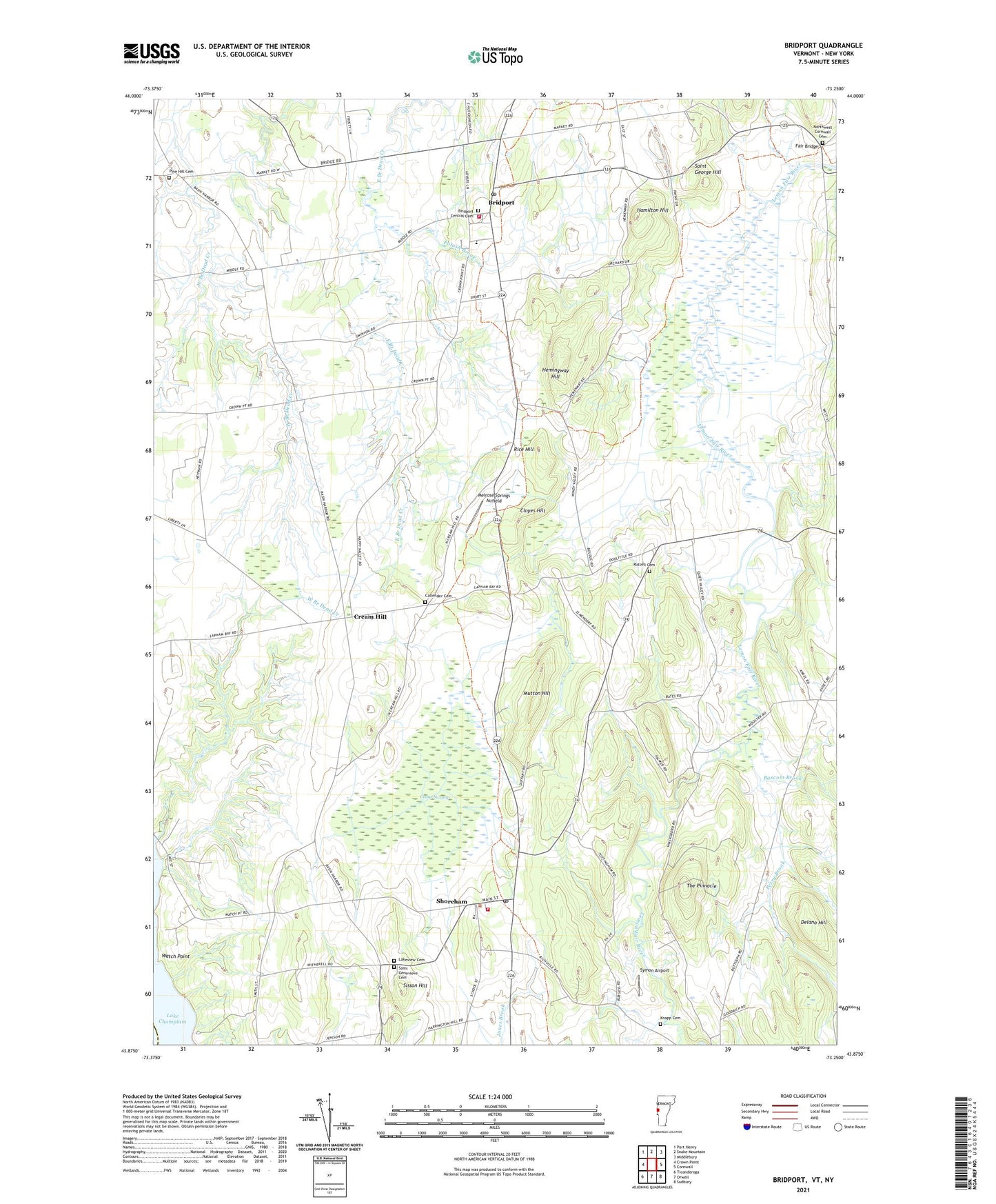
2021 topographic map quadrangle Bridport in the state of Vermont. Scale: 1:24000. Based on the newly updated USGS 7.5' US Topo map series, this map is in the following counties: Addison, Essex. The map contains contour data, water features, and other items you are used to seeing on USGS maps, but also has updated roads and other features. This is the next generation of topographic maps. Printed on high-quality waterproof paper with UV fade-resistant inks.
Quads adjacent to this one:
West: Crown Point
Northwest: Port Henry
North: Snake Mountain
Northeast: Middlebury
East: Cornwall
Southeast: Sudbury
South: Orwell
Southwest: Ticonderoga
Contains the following named places: All Saint Chapel, Bascom Brook, Bridport, Bridport Central Cemetery, Bridport Central School, Bridport Congregational Church, Bridport Post Office, Bridport Public Library, Bridport Volunteer Fire Department, Callender Cemetery, Cedar Swamp, Cloyes Hill, Cream Hill, Delano Hill, District Six Schoolhouse, Fair Bridge, Hamilton Hill, Hemingway Hill, Knapp Cemetery, Lakeview Cemetery, Melrose Springs Airfield, Mutton Hill, Northwest Cornwall Cemetery, Perry Brook, Pine Hill Cemetery, Platt Memorial Library, Potash Brook, Rice Hill, Richville Dam, Richville Pond, Russell Cemetery, Saint Bernadette Church, Saint Genevieve Cemetery, Saint Genevieve Church, Saint George Hill, School Number 6, Shoreham, Shoreham Congregational Church, Shoreham Elementary School, Shoreham Fire Department, Shoreham Post Office, Sisson Hill, Symon Airport, The Pinnacle, Torrey Airport, Town of Bridport, Town of Shoreham, Watch Point, ZIP Codes: 05734, 05770