MyTopo
Sudbury Vermont US Topo Map
Couldn't load pickup availability
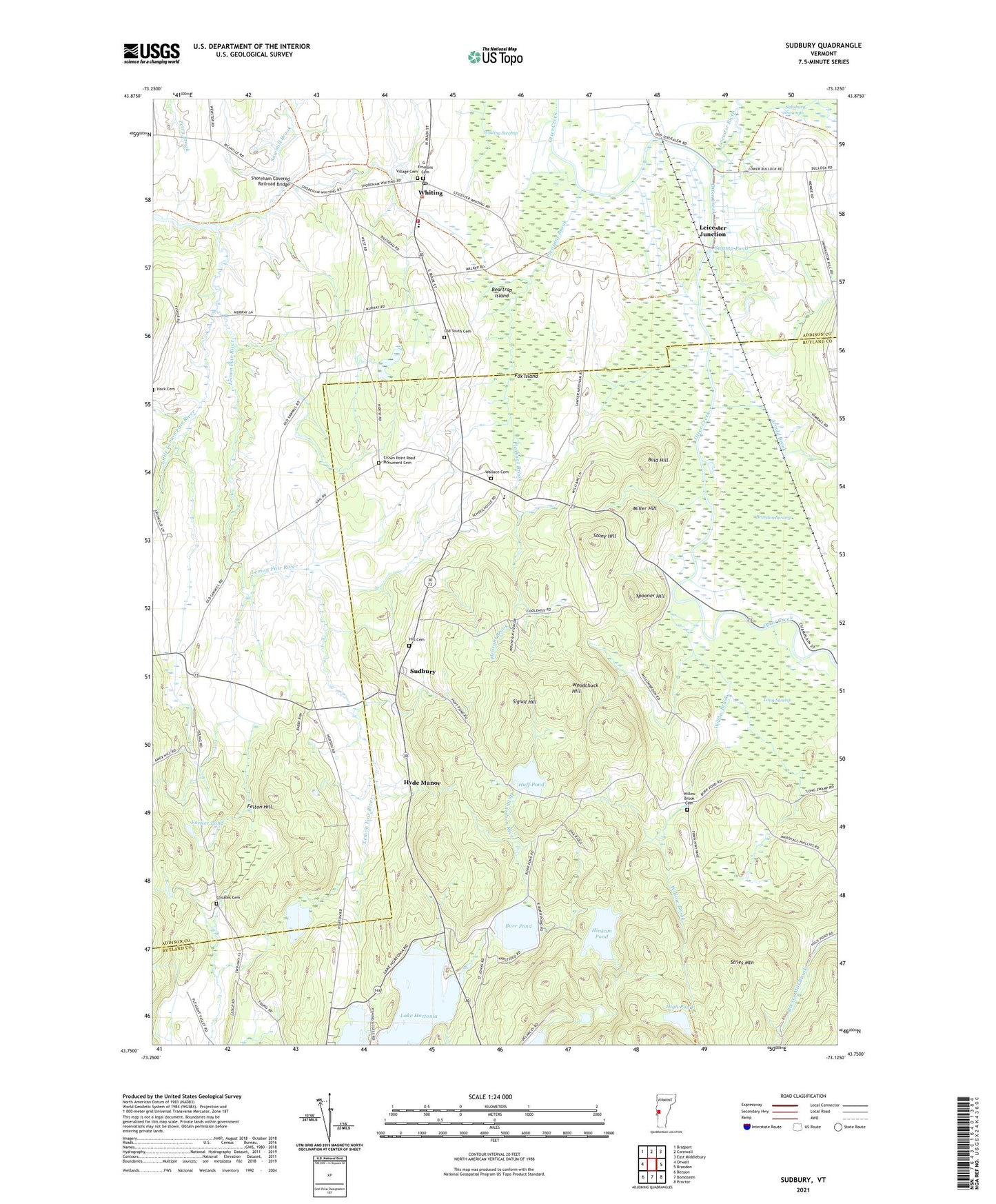
2024 topographic map quadrangle Sudbury in the state of Vermont. Scale: 1:24000. Based on the newly updated USGS 7.5' US Topo map series, this map is in the following counties: Rutland, Addison. The map contains contour data, water features, and other items you are used to seeing on USGS maps, but also has updated roads and other features. This is the next generation of topographic maps. Printed on high-quality waterproof paper with UV fade-resistant inks.
Quads adjacent to this one:
West: Orwell
Northwest: Bridport
North: Cornwall
Northeast: East Middlebury
East: Brandon
Southeast: Proctor
South: Bomoseen
Southwest: Benson
This map covers the same area as the classic USGS quad with code o43073g2.
Contains the following named places: Andys Camp, Arnold Brook, Bald Hill, Beartrap Island, Brandon Swamp, Brandon Swamp Wildlife Management Area, Burr Pond, Burr Pond Dam, Burr Pond School, Camp Sky Bird, Choates Cemetery, Crown Point Road Monument, Crown Point Road Monument Cemetery, Felton Hill, Felton School, Fortier Pond, Fox Island, G F Emmons Cemetery, High Pond, Hill Cemetery, Hill School, Hinkum Pond, Huff Pond, Hyde Manor, Johnson Pond, Lake Hortonia, Leicester Junction, Leicester River, Little Lemon Fair River, Long Swamp, Miller Hill, Old South Cemetery, Pleasant Brook, Richville Wildlife Management Area, Sawmill Brook, School Number 1, School Number 4, Shoreham Covered Railroad Bridge, Signal Hill, South Whiting School, Spooner Hill, Stiles Mountain, Stony Hill, Sudbury, Sudbury Congregational Church, Sudbury Country School, Sudbury Town Hall, Swamp Pond, Town of Sudbury, Town of Whiting, Village Cemetery, Wallace Cemetery, Warrior Lakes, Webster School, Whiting, Whiting Community Church, Whiting Post Office, Whiting Village School, Whiting Volunteer Fire Department, Willow Brook, Willow Brook Cemetery, Willow Brook School, Woodchuck Hill, Young School