MyTopo
Cold Hollow Mountains Vermont US Topo Map
Couldn't load pickup availability
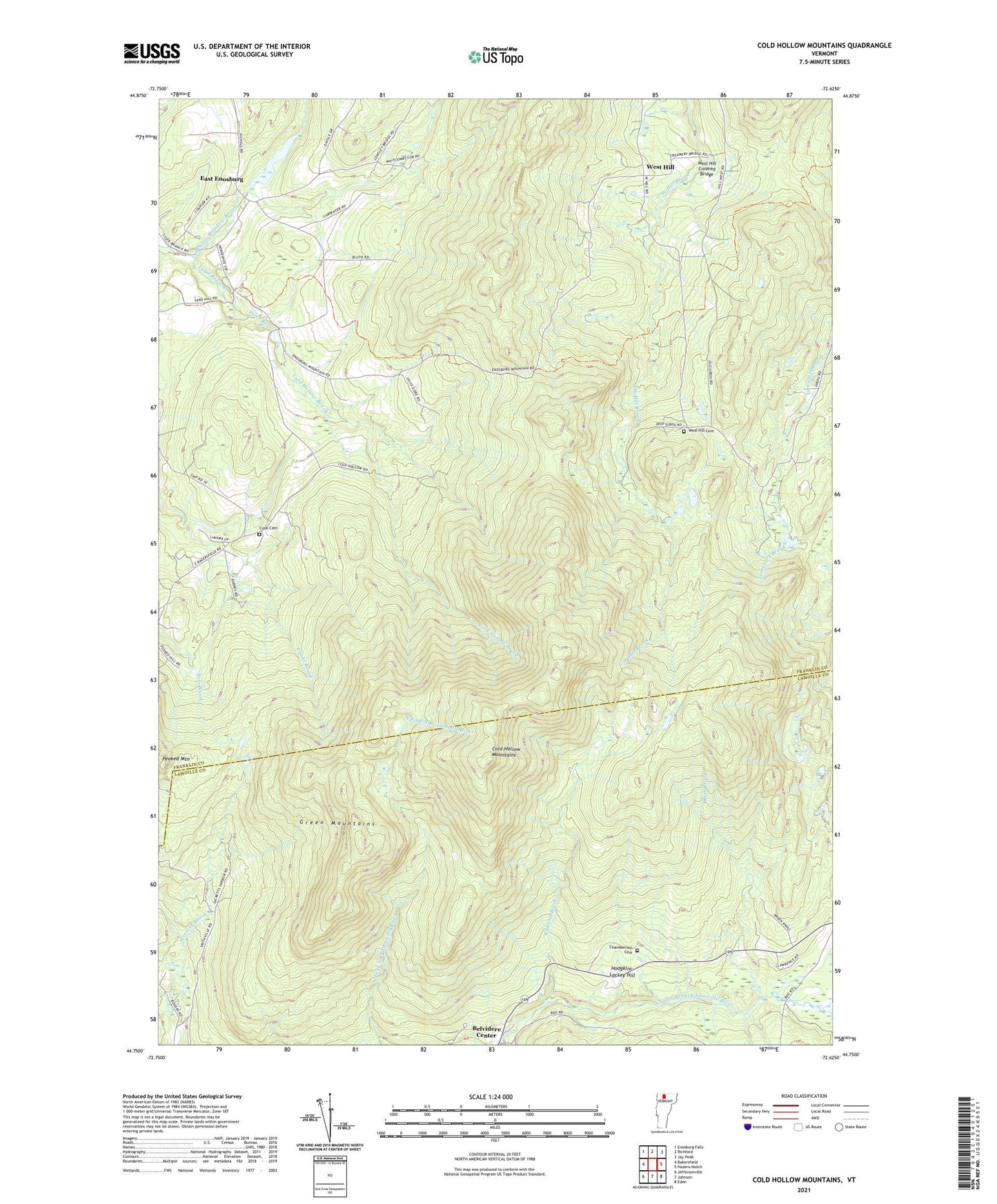
2021 topographic map quadrangle Cold Hollow Mountains in the state of Vermont. Scale: 1:24000. Based on the newly updated USGS 7.5' US Topo map series, this map is in the following counties: Franklin, Lamoille. The map contains contour data, water features, and other items you are used to seeing on USGS maps, but also has updated roads and other features. This is the next generation of topographic maps. Printed on high-quality waterproof paper with UV fade-resistant inks.
Quads adjacent to this one:
West: Bakersfield
Northwest: Enosburg Falls
North: Richford
Northeast: Jay Peak
East: Hazens Notch
Southeast: Eden
South: Johnson
Southwest: Jeffersonville
Contains the following named places: Beaver Meadow Brook, Belvidere Center, Chamberlain Cemetery, Clapp Cemetery, Cold Hollow Brook, Cold Hollow Mountains, Cook Cemetery, Cooks School, East Enosburg, Hodgkins-Lackey Hill, Lost Pond, Otter Brook, Peaked Mountain, Perkins Brook, Rattling Brook, Town of Belvidere, West Hill, West Hill Cemetery, West Hill Covered Bridge, ZIP Codes: 05441, 05442