MyTopo
Eden Vermont US Topo Map
Couldn't load pickup availability
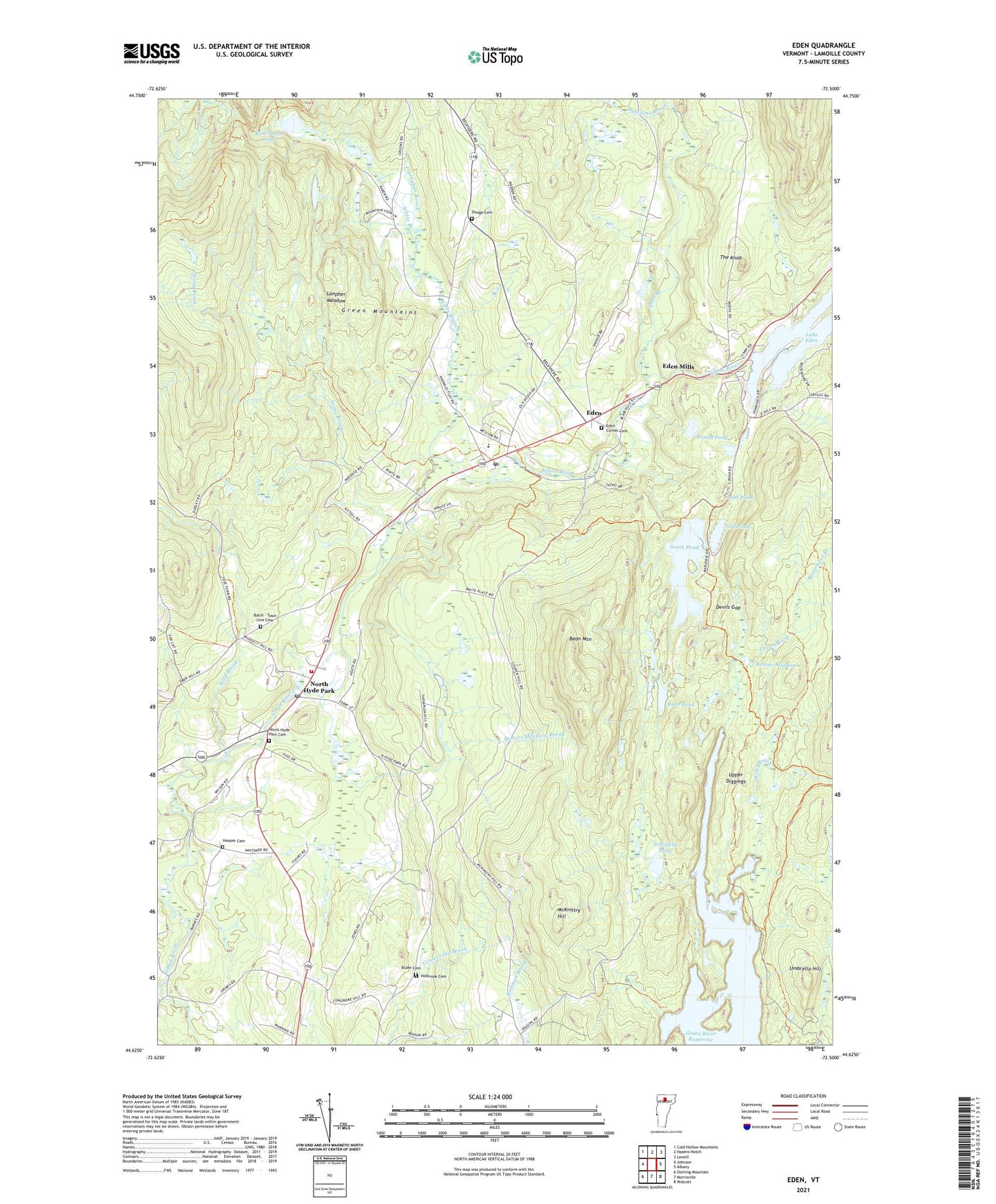
2024 topographic map quadrangle Eden in the state of Vermont. Scale: 1:24000. Based on the newly updated USGS 7.5' US Topo map series, this map is in the following counties: Lamoille. The map contains contour data, water features, and other items you are used to seeing on USGS maps, but also has updated roads and other features. This is the next generation of topographic maps. Printed on high-quality waterproof paper with UV fade-resistant inks.
Quads adjacent to this one:
West: Johnson
Northwest: Cold Hollow Mountains
North: Hazens Notch
Northeast: Lowell
East: Albany
Southeast: Wolcott
South: Morrisville
Southwest: Sterling Mountain
This map covers the same area as the classic USGS quad with code o44072f5.
Contains the following named places: Balch - Town Line Cemetery, Bean Mountain, Beaver Meadow, Beaver Meadow Brook, Blake Cemetery, Boomhour Branch, Dark Branch, Devils Gap, Dodge Cemetery, Eden, Eden Central School, Eden Corner Cemetery, Eden Mills, Eden Mills Congregational Church, Eden Post Office, Fryingpan Brook, Green River Dam, Green River Reservoir, Gut Pond, Holbrook Cemetery, Hooper Cemetery, Hutchins Brook, Lake Eden, Lake Eden Dam, Lakeview Campground, Lanpher Meadow, McKinstry Hill, Mud Pond, North Hyde Park, North Hyde Park - Eden Fire Department, North Hyde Park Cemetery, North Hyde Park Census Designated Place, North Hyde Park Post Office, Ritterbush Camp, Ritterbush Pond, Round Pond, Rush Pond, Saint Gabriels Catholic Church, Schofield Pond, South Pond, South Pond Dam, Stony Brook, The Knob, Town of Eden, Umbrella Hill, Upper Diggings, White Branch, Wild Brook, Wiley Brook, ZIP Code: 05652