MyTopo
Concord Vermont US Topo Map
Couldn't load pickup availability
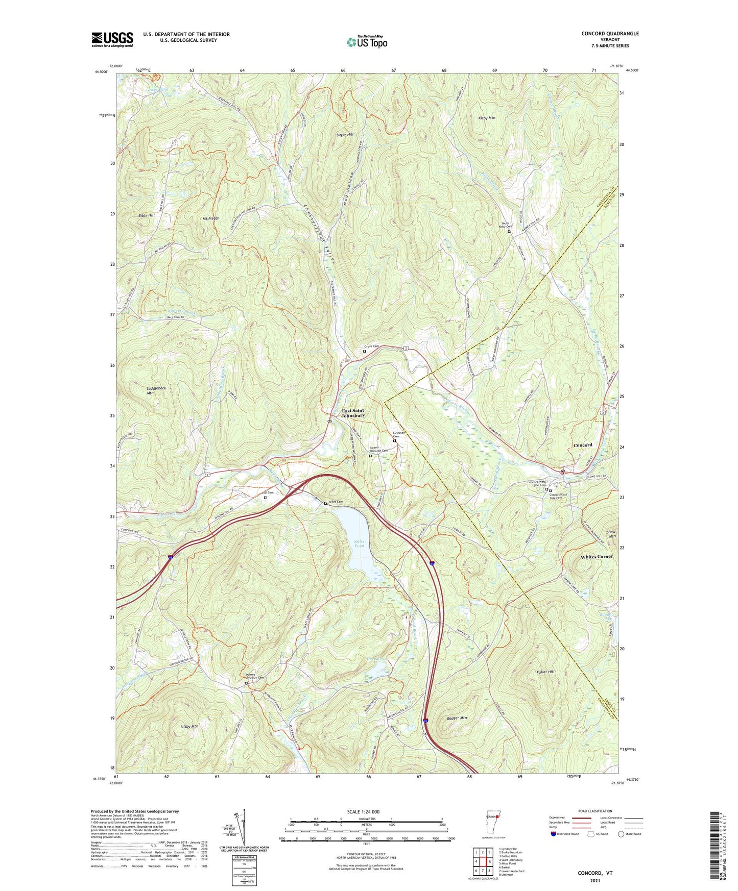
2021 topographic map quadrangle Concord in the state of Vermont. Scale: 1:24000. Based on the newly updated USGS 7.5' US Topo map series, this map is in the following counties: Caledonia, Essex. The map contains contour data, water features, and other items you are used to seeing on USGS maps, but also has updated roads and other features. This is the next generation of topographic maps. Printed on high-quality waterproof paper with UV fade-resistant inks.
Quads adjacent to this one:
West: Saint Johnsbury
Northwest: Lyndonville
North: Burke Mountain
Northeast: Gallup Mills
East: Miles Pond
Southeast: Littleton
Contains the following named places: Adams - Babcock Cemetery, Badger Mountain, Bible Hill, Caste School, Chesterfield Valley, Concord, Concord Census Designated Place, Concord East Side Cemetery, Concord Fire and Rescue, Concord High School / Graded School, Concord Post Office, Concord West Side Cemetery, Cushman Cemetery, Duck Pond, Duck Pond Brook, East Saint Johnsbury, East Saint Johnsbury Post Office, Essex - Caledonia Supervisory Union, Fuller Hill, Graves School, Grays Pond, Grove Cemetery, Hastings School, Hill Cemetery, Kirby Brook, Kirby Mountain Quarries, Maple Grove Museum, Moose River Campground, Mount Pisgah, Mud Hollow, Powers Wheeler Cemetery, Ranney Brook, Remick School, Rustic Haven Campground, Saddleback Mountain, Saint Johnsbury Municipal Forest, Silsby Mountain, South Kirby, South Kirby Cemetery, South Kirby School, Spaulding Brook, Stiles Brook, Stiles Cemetery, Stiles Pond, Stiles Pond Dam, Stockwell Brook, Sugar Hill, Third Congregational Church, Town of Waterford, Waterford Elementary School, Waterford Volunteer Fire Department, Whites Corner, WNKV-FM (Saint Johnsbury), WSTJ-AM (Saint Johnsbury), ZIP Code: 05819