MyTopo
Gallup Mills Vermont US Topo Map
Couldn't load pickup availability
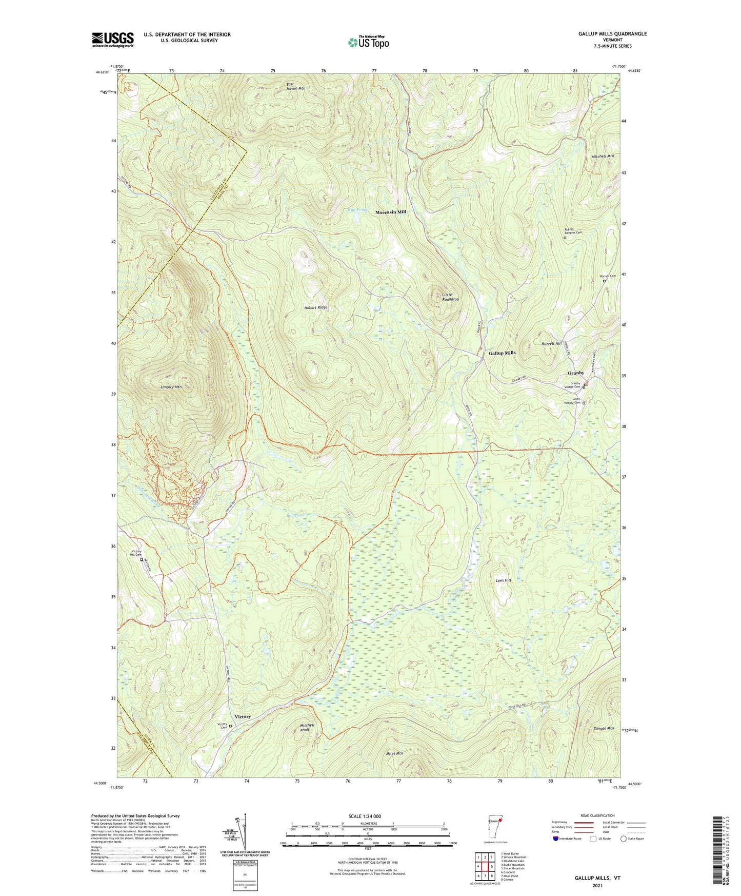
2024 topographic map quadrangle Gallup Mills in the state of Vermont. Scale: 1:24000. Based on the newly updated USGS 7.5' US Topo map series, this map is in the following counties: Essex, Caledonia. The map contains contour data, water features, and other items you are used to seeing on USGS maps, but also has updated roads and other features. This is the next generation of topographic maps. Printed on high-quality waterproof paper with UV fade-resistant inks.
Quads adjacent to this one:
West: Burke Mountain
Northwest: West Burke
North: Seneca Mountain
East: Stone Mountain
Southeast: Gilman
South: Miles Pond
Southwest: Concord
This map covers the same area as the classic USGS quad with code o44071e7.
Contains the following named places: Bog Brook, Bog Pond, Buzzell Hill, Cold Brook, Damon Crossing, East Haven Mountain, Gallup Mills, Granby, Granby Brook, Granby Central School, Granby Post Office, Granby Village Cemetery, Hay Hill Brook, Hobart Ridge, James Brook, Jones Brook, Lees Hill, Line Brook, Little Roundtop, Lund Brook, Mitchell Knoll, Mitchell Mountain, Moccasin Mill, Mud Pond, North Victory Cemetery, Porrell Cemetery, Rogers Brook, Rogers Rangers Cemetery, Schoolhouse Brook, Stanley Brook, Town of Victory, Umpire Brook, Umpire Mountain, Victory, Victory Cemetery, Victory Hill Cemetery, Victory State Forest, Weir Mill Brook, ZIP Code: 05858