MyTopo
East Alburg OE N Vermont US Topo Map
Couldn't load pickup availability
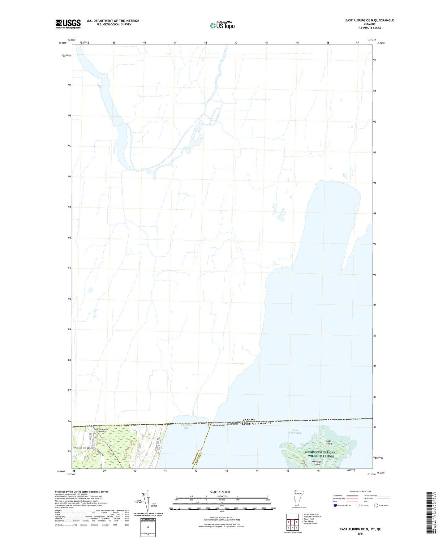
2024 topographic map quadrangle East Alburg OE N in the state of Vermont. Scale: 1:24000. Based on the newly updated USGS 7.5' US Topo map series, this map is in the following counties: Franklin, Grand Isle. The map contains contour data, water features, and other items you are used to seeing on USGS maps, but also has updated roads and other features. This is the next generation of topographic maps. Printed on high-quality waterproof paper with UV fade-resistant inks.
Quads adjacent to this one:
West: Rouses Point OE N
East: Highgate Center OE N
Southeast: Highgate Center
South: East Alburg
Southwest: Rouses Point
Contains the following named places: Chapman Bay, East Branch Missisquoi River, Eel Creek, Greenwood Cemetery, Greenwoods Airfield, Metcalfe Island, Missisquoi Bay, Province Point, Shad Island, West Branch Missisquoi River