MyTopo
East Alburg Vermont US Topo Map
Couldn't load pickup availability
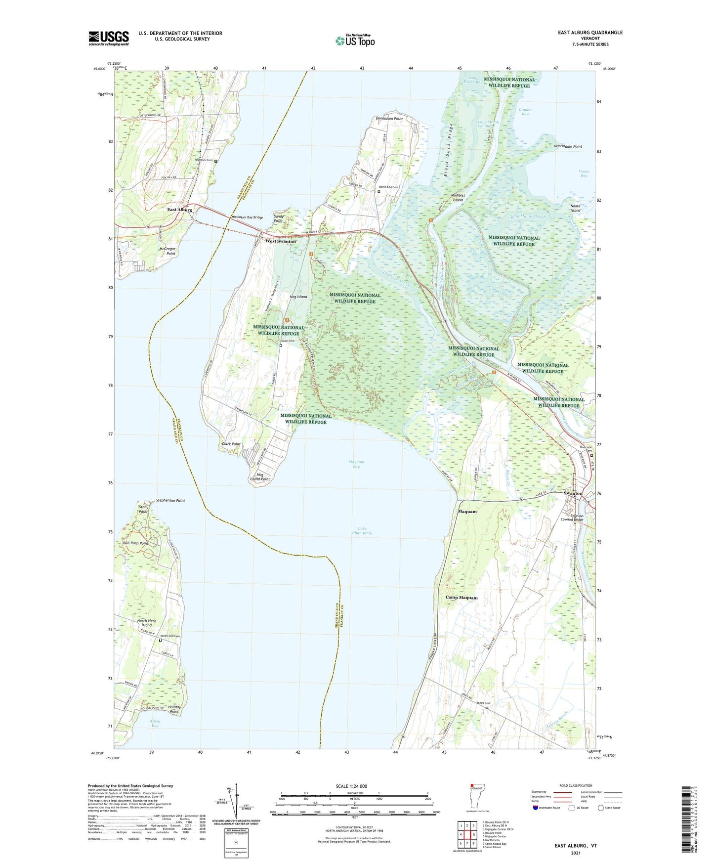
2024 topographic map quadrangle East Alburg in the state of Vermont. Scale: 1:24000. Based on the newly updated USGS 7.5' US Topo map series, this map is in the following counties: Franklin, Grand Isle. The map contains contour data, water features, and other items you are used to seeing on USGS maps, but also has updated roads and other features. This is the next generation of topographic maps. Printed on high-quality waterproof paper with UV fade-resistant inks.
Quads adjacent to this one:
West: Rouses Point
Northwest: Rouses Point OE N
North: East Alburg OE N
Northeast: Highgate Center OE N
East: Highgate Center
Southeast: Saint Albans
South: Saint Albans Bay
Southwest: North Hero
This map covers the same area as the classic USGS quad with code o44073h2.
Contains the following named places: Alburg Springs, Alburg Travel Trailer Park, Alburg-Swanton Ferry, Allens Bay, Big Marsh Slough, Black Creek, Black Duck Ridge, Brush Creek, Camp Maquam, Campbells Bay Campground, Champlain Valley Campground, Charcoal Creek, Clark Point, Cranberry Creek, Cripple Brush Creek, Dead Creek, Donaldson Point, East Alburg, First Creek, Gander Bay, Goose Bay, Hog Island, Hog Island Point, Holiday Point, Janes Cemetery, Lakewood Campground, Long Marsh Bay, Long Marsh Channel, Maquam, Maquam Bay, Maquam Bay Wildlife Management Area, Maquam Creek, Martindale Point, McGregor Point, Missisquoi Bay Bridge, Missisquoi National Wildlife Refuge, Missisquoi River, Mudgett Island, Noaks Island, North End Cemetery, North Hero State Park, Reynolds Cemetery, Riverside Cemetery, Sandy Point, Stephenson Point, Stony Point, Swanton Chamber of Commerce, Swanton Covered Bridge, Swanton Dam, Tabor Cemetery, Town of Swanton, West Swanton, Wood Duck Creek, ZIP Code: 05488