MyTopo
Mount Holly Vermont US Topo Map
Couldn't load pickup availability
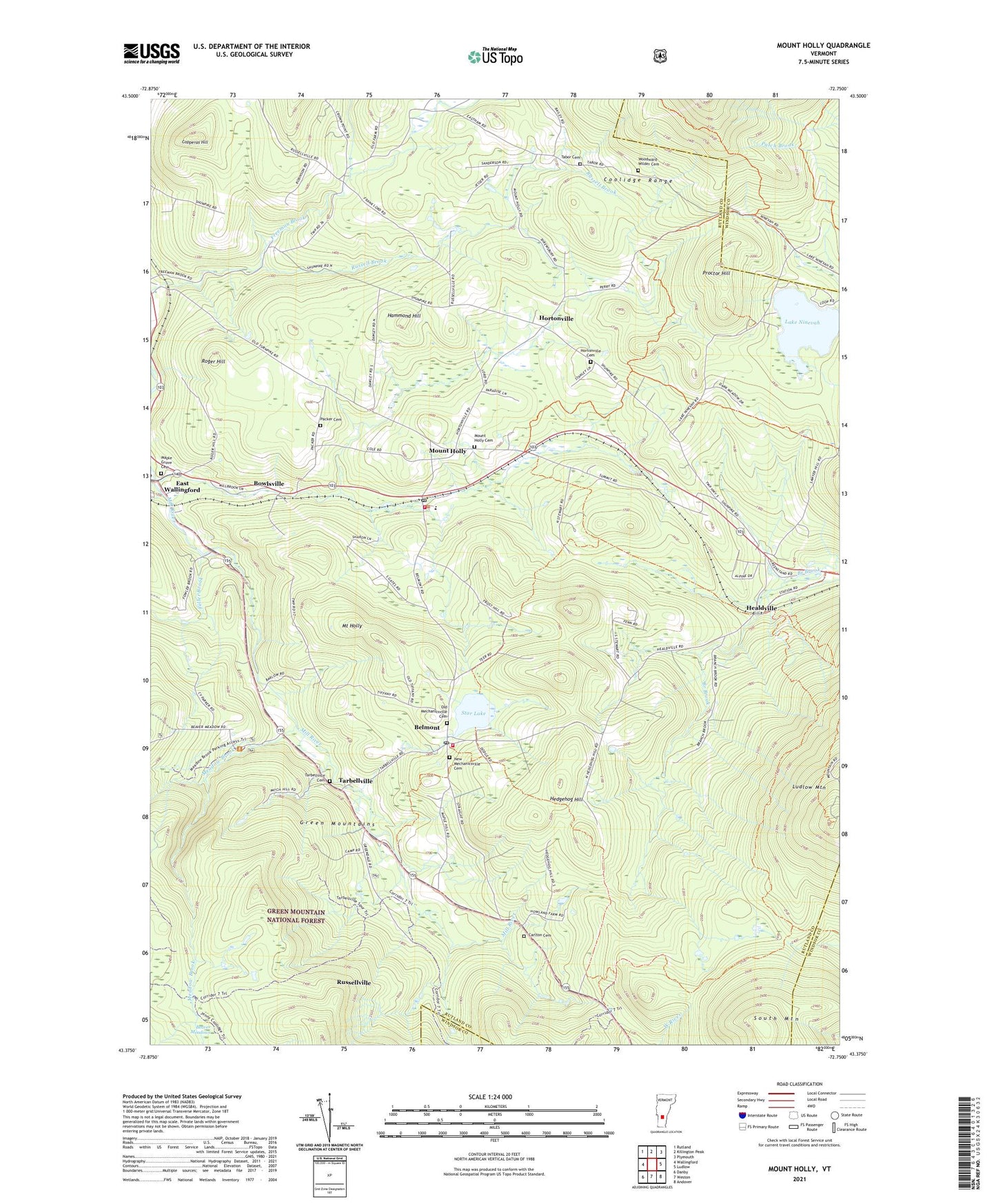
2021 topographic map quadrangle Mount Holly in the state of Vermont. Scale: 1:24000. Based on the newly updated USGS 7.5' US Topo map series, this map is in the following counties: Rutland, Windsor. The map contains contour data, water features, and other items you are used to seeing on USGS maps, but also has updated roads and other features. This is the next generation of topographic maps. Printed on high-quality waterproof paper with UV fade-resistant inks.
Quads adjacent to this one:
West: Wallingford
Northwest: Rutland
North: Killington Peak
Northeast: Plymouth
East: Ludlow
Southeast: Andover
South: Weston
Southwest: Danby
Contains the following named places: Amherst Lake, Amherst Lake Dam, Belmont, Belmont Post Office, Bowlsville, Calvin Coolidge State Forest, Camp Windsor, Carlton Cemetery, Community Historical Museum of Mount Holly, Copperas Hill, Hammond Hill, Healdville, Hedgehog Hill, Hortonville, Hortonville Cemetery, Lake Ninevah, Lake Ninevah Dam, Ludlow Mountain, Maple Grove Cemetery, Meadow Brook, Mount Holly, Mount Holly Cemetery, Mount Holly Elementary School, Mount Holly Heights, Mount Holly Post Office, Mount Holly Town Hall, Mount Holly Volunteer Fire Department Station 1, Mount Holly Volunteer Fire Department Station 2, Mount Holly Volunteer Rescue Squad, New Mechanicsville Cemetery, Okemo State Forest, Old Mechanicsville Cemetery, Packer Cemetery, Park Meadows Camping Area, Proctor Hill, Roger Hill, Russell Brook, Russellville, South Mountain, Star Lake, Star Lake Dam, Summit, Tabor Cemetery, Tarbellville, Tarbellville Cemetery, Town of Mount Holly, Woodward-Wilder Cemetery, ZIP Codes: 05730, 05758