MyTopo
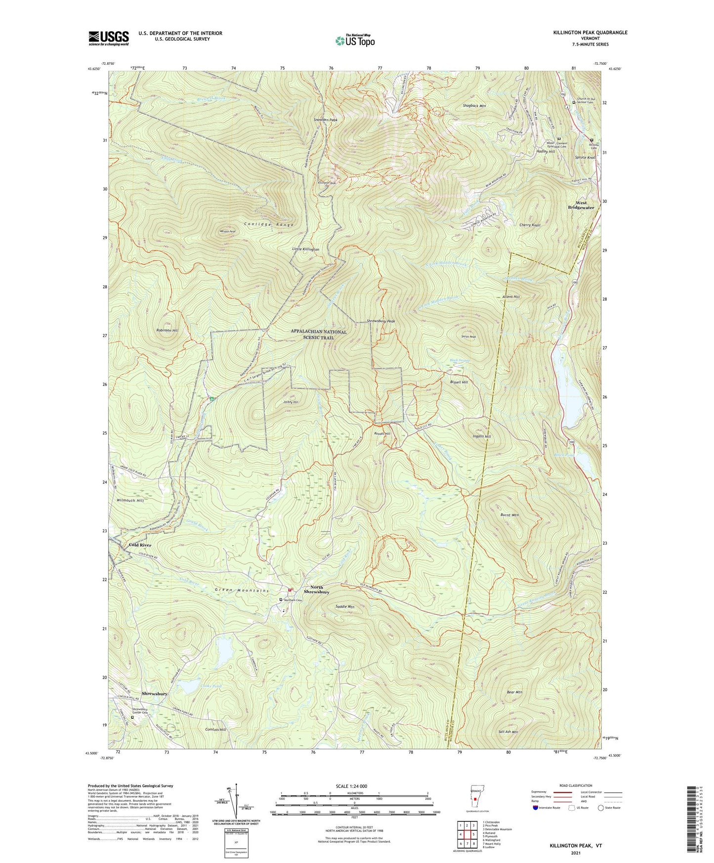
Killington Peak Vermont US Topo Map
Couldn't load pickup availability
Also explore the Killington Peak Forest Service Topo of this same quad for updated USFS data
2024 topographic map quadrangle Killington Peak in the state of Vermont. Scale: 1:24000. Based on the newly updated USGS 7.5' US Topo map series, this map is in the following counties: Rutland, Windsor. The map contains contour data, water features, and other items you are used to seeing on USGS maps, but also has updated roads and other features. This is the next generation of topographic maps. Printed on high-quality waterproof paper with UV fade-resistant inks.
Quads adjacent to this one:
West: Rutland
Northwest: Chittenden
North: Pico Peak
Northeast: Delectable Mountain
East: Plymouth
Southeast: Ludlow
South: Mount Holly
Southwest: Wallingford
This map covers the same area as the classic USGS quad with code o43072e7.
Contains the following named places: Allens Hill, Bear Mountain, Bissell Hill, Black Pond, Black Pond Dam, Black Swamp, Bucklin Trail, Burnt Mountain, Calvin Coolidge State Forest, Cherry Knoll, Church of Our Saviour Cemetery, Comtois Hill, Cooks Pond, Coolidge Range, Falls Brook, Gould Brook, Hadley Hill, Hillside Cemetery, Ingalls Hill, Jockey Hill, Johnson Pond, Juggernaut Trail, Killington Peak, Killington Ski Area, Little Killington, Madden Brook, Mendon Peak, Mission Chapel, North Fork Madden Brook, North Shrewsbury, Northam Cemetery, Northam School, Plymsbury Wildlife Management Area, Robinson Hill, Russell Hill, Saddle Mountain, Salt Ash Mountain, Sargent Brook, Shagback Mountain, Shrewsbury, Shrewsbury Center Cemetery, Shrewsbury Mountain School, Shrewsbury Peak, Shrewsbury Volunteer Fire Department Station 2, Smith Peak, Snowden Peak, South Fork Madden Brook, South Sherburne, Spruce Knoll, Tinker Brook, Town of Shrewsbury, Wilmouth Hill, WJJR-FM (Rutland), Wood - Clement Episcopal Cemetery, Woodward Reservoir, Woodward Reservoir Dam, WZRT-FM (Rutland), ZIP Code: 05738