MyTopo
Mount Philo Vermont US Topo Map
Couldn't load pickup availability
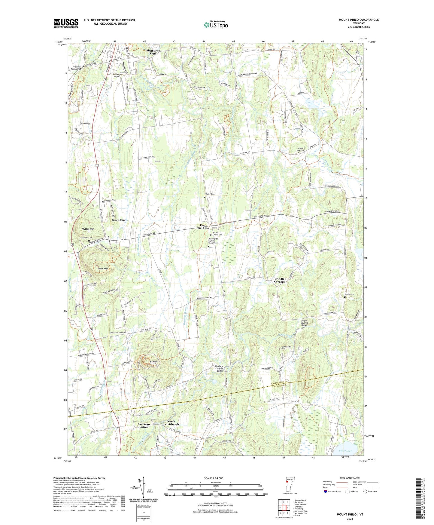
2021 topographic map quadrangle Mount Philo in the state of Vermont. Scale: 1:24000. Based on the newly updated USGS 7.5' US Topo map series, this map is in the following counties: Chittenden, Addison. The map contains contour data, water features, and other items you are used to seeing on USGS maps, but also has updated roads and other features. This is the next generation of topographic maps. Printed on high-quality waterproof paper with UV fade-resistant inks.
Quads adjacent to this one:
West: Charlotte
Northwest: Juniper Island
North: Burlington
Northeast: Essex Junction
East: Hinesburg
Southeast: Bristol
South: Vergennes East
Southwest: Vergennes West
Contains the following named places: Baldwin School, Bingham Brook, Bradley Cemetery, Burritt Cemetery, Cedar Lake, Charlotte Central School, Coleman Corner, East Charlotte, East Charlotte Census Designated Place, Frogs End Airport, Grandview Cemetery, Grandview Congregational Church, Morningside Baptist Church Cemetery, Mount Carmel Catholic Church, Mount Carmel Cemetery, Mount Philo, Mount Philo School, Mount Philo State Park, Mud Hollow Brook, Mutton Hill, New Palmer School, North Ferrisburgh, North Ferrisburgh Post Office, O'Neil Road Cemetery, Pease Mountain, Prindle Corners, Prindle School, Quinlans Covered Bridge, Rocky Ridge Golf Course, Scott Pond, Sequin Covered Bridge, Shelburne Airport, Shelburne Falls, Shelburne Museum Research Library, Shelburne Post Office, Spruce Ridge, Town of Charlotte, WIZN-FM (Vergennes), ZIP Code: 05445