MyTopo
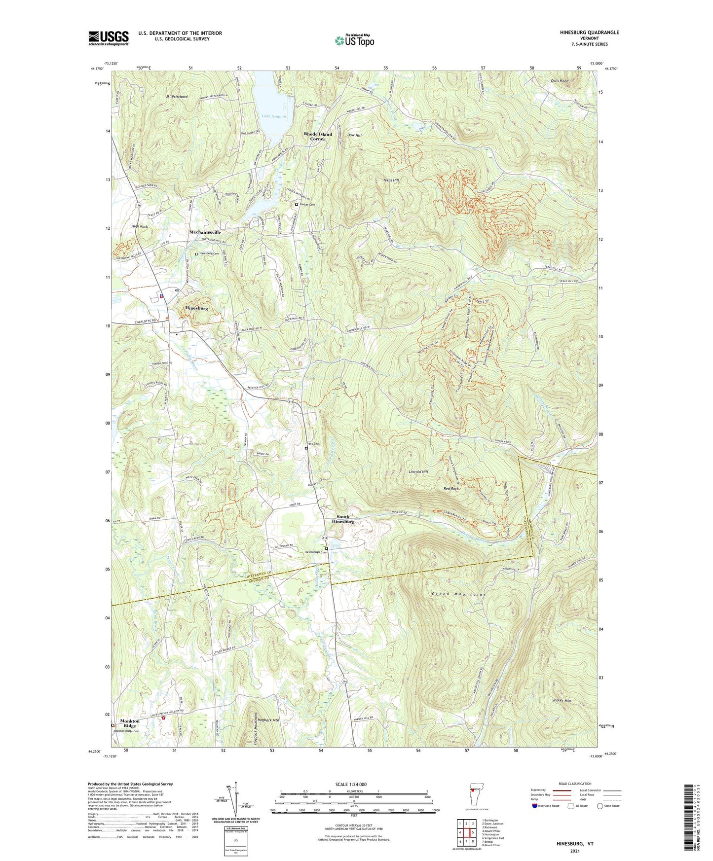
Hinesburg Vermont US Topo Map
Couldn't load pickup availability
2024 topographic map quadrangle Hinesburg in the state of Vermont. Scale: 1:24000. Based on the newly updated USGS 7.5' US Topo map series, this map is in the following counties: Chittenden, Addison. The map contains contour data, water features, and other items you are used to seeing on USGS maps, but also has updated roads and other features. This is the next generation of topographic maps. Printed on high-quality waterproof paper with UV fade-resistant inks.
Quads adjacent to this one:
West: Mount Philo
Northwest: Burlington
North: Essex Junction
Northeast: Richmond
East: Huntington
Southeast: Mount Ellen
South: Bristol
Southwest: Vergennes East
This map covers the same area as the classic USGS quad with code o44073c1.
Contains the following named places: Annettes Playschool Il, Barker Cemetery, Champlain Valley Union High School, Dow Hill, Fred Johnson Wildlife Management Area, High Rock, Hinesburg, Hinesburg Cemetery, Hinesburg Census Designated Place, Hinesburg Community School, Hinesburg Fire Department, Hinesburg Police Department, Hinesburg Post Office, Hogback Mountain, Hollow Brook, Lake Iroquois, Lake Iroquois Dam, Lincoln Hill, Lower Pond, Lower Pond Dam, McDonough Cemetery, Mechanicsville, Monkton Post Office, Monkton Ridge, Monkton Ridge Cemetery, Monkton Volunteer Fire Department, Mount Pritchard, Owls Head, Patrick Brook, Pond Brook, Red Rock, Rhode Island Corner, Sarah Carpenter Memorial Library, Shaker Mountain, Sherman Hollow Ski Touring Center, South Hinesburg, Texas Hill, Town of Hinesburg, Tracy Cemetery, ZIP Code: 05461