MyTopo
Newport Center Vermont US Topo Map
Couldn't load pickup availability
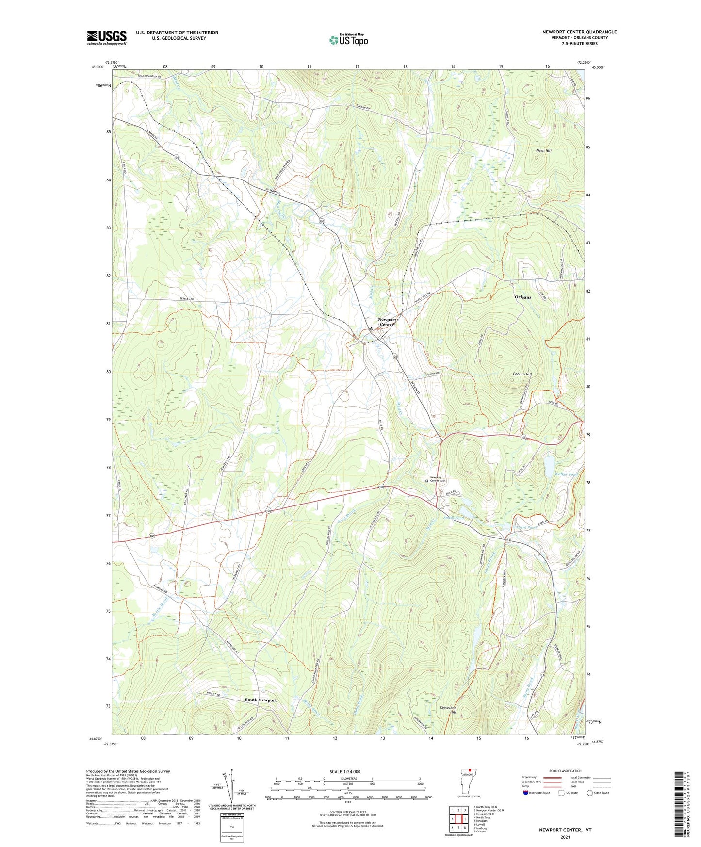
2024 topographic map quadrangle Newport Center in the state of Vermont. Scale: 1:24000. Based on the newly updated USGS 7.5' US Topo map series, this map is in the following counties: Orleans. The map contains contour data, water features, and other items you are used to seeing on USGS maps, but also has updated roads and other features. This is the next generation of topographic maps. Printed on high-quality waterproof paper with UV fade-resistant inks.
Quads adjacent to this one:
West: North Troy
Northwest: North Troy OE N
North: Newport Center OE N
Northeast: Newport OE N
East: Newport
Southeast: Orleans
South: Irasburg
Southwest: Lowell
This map covers the same area as the classic USGS quad with code o44072h3.
Contains the following named places: Allen Hill, Brown School, Burington School, Cleveland Hill, Coburn Hill, Dunn Brook, Farrar School, Newport Center, Newport Center Cemetery, Newport Center Census Designated Place, Newport Center Post Office, Newport Town Elementary School, Sargent Pond, Smith Pond, South Newport, Summit Siding, Town of Newport, Walker Pond, West Hill School, ZIP Code: 05857