MyTopo
North Troy Vermont US Topo Map
Couldn't load pickup availability
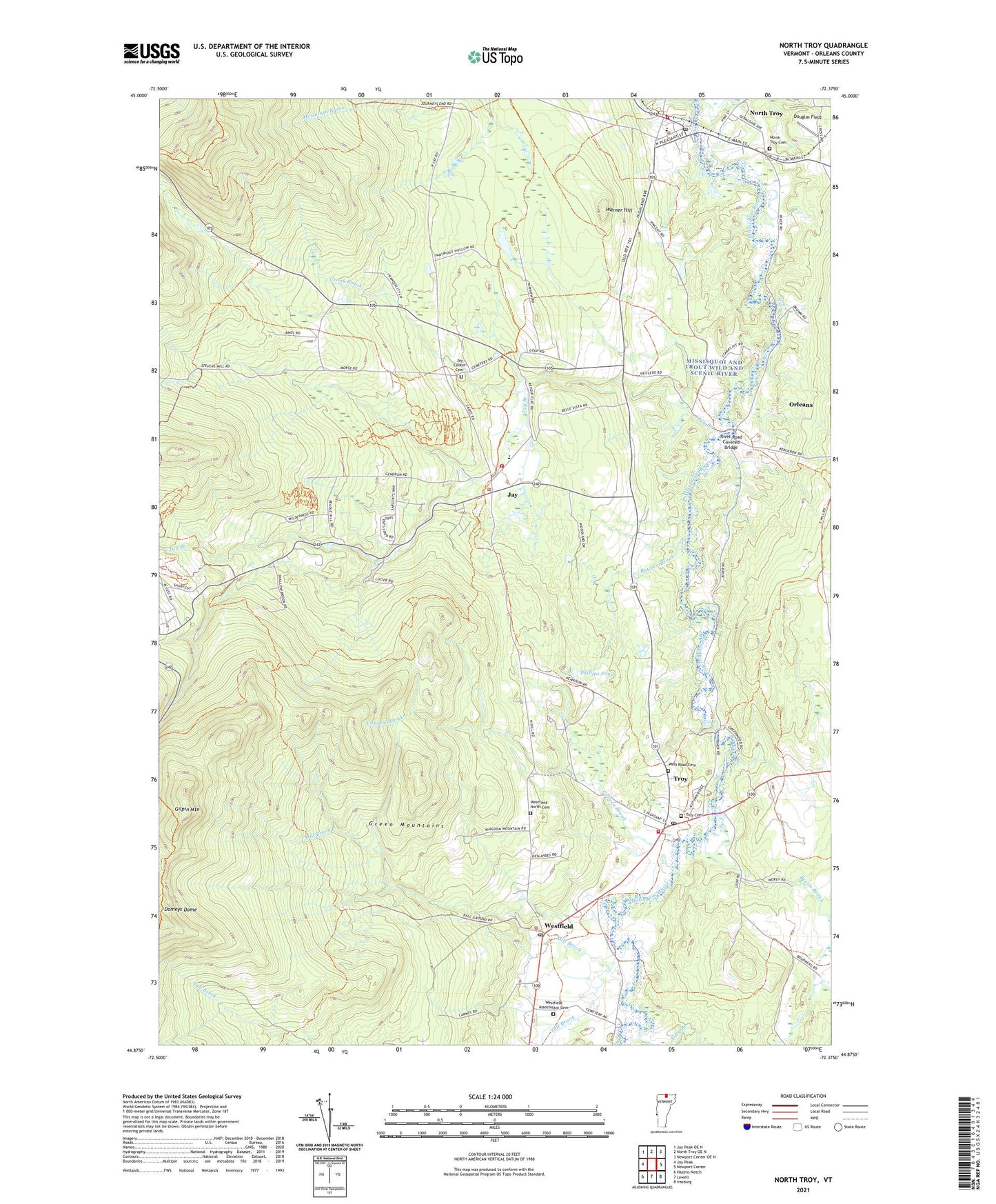
2024 topographic map quadrangle North Troy in the state of Vermont. Scale: 1:24000. Based on the newly updated USGS 7.5' US Topo map series, this map is in the following counties: Orleans. The map contains contour data, water features, and other items you are used to seeing on USGS maps, but also has updated roads and other features. This is the next generation of topographic maps. Printed on high-quality waterproof paper with UV fade-resistant inks.
Quads adjacent to this one:
West: Jay Peak
Northwest: Jay Peak OE N
North: North Troy OE N
Northeast: Newport Center OE N
East: Newport Center
Southeast: Irasburg
South: Lowell
Southwest: Hazens Notch
This map covers the same area as the classic USGS quad with code o44072h4.
Contains the following named places: Bakers Falls Dam, Beetle Brook, Big Falls, Buybee Brook, Coburn Brook, Crook Brook, Domeys Dome, Douglas Field, Gilpin Mountain, Jay, Jay Branch, Jay Center Cemetery, Jay Volunteer Fire Department, Jay Westfield Elementary School, Lilly Branch, Mill Brook, Mill Brook Campground, Missisquoi Valley Ambulance Service, North Troy, North Troy Cemetery, North Troy Fire Department, North Troy Post Office, Phillips Pond, River Road Covered Bridge, Taft Brook, Town of Jay, Town of Troy, Town of Westfield, Troy, Troy Cemetery, Troy Census Designated Place, Troy Post Office, Troy School, Troy Volunteer Fire Department, Village of North Troy, Warner Hill, West Road Cemetery, Westfield, Westfield Association Cemetery, Westfield Municipal Forest, Westfield North Cemetery, Westfield Post Office, William H and Lucy F Rand Memorial Library, ZIP Codes: 05859, 05868, 05874