MyTopo
Plymouth Vermont US Topo Map
Couldn't load pickup availability
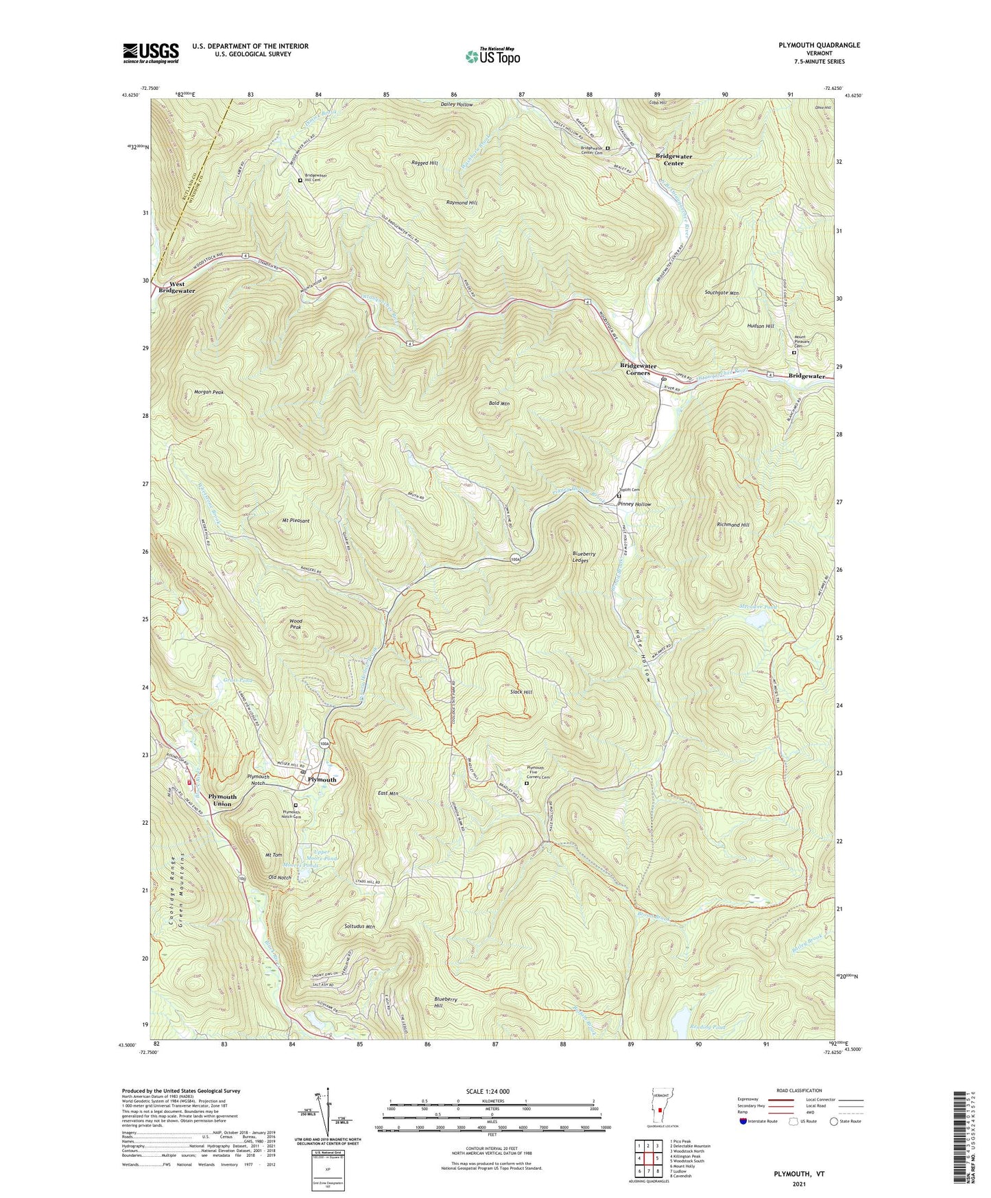
2021 topographic map quadrangle Plymouth in the state of Vermont. Scale: 1:24000. Based on the newly updated USGS 7.5' US Topo map series, this map is in the following counties: Windsor, Rutland. The map contains contour data, water features, and other items you are used to seeing on USGS maps, but also has updated roads and other features. This is the next generation of topographic maps. Printed on high-quality waterproof paper with UV fade-resistant inks.
Quads adjacent to this one:
West: Killington Peak
Northwest: Pico Peak
North: Delectable Mountain
Northeast: Woodstock North
East: Woodstock South
Southeast: Cavendish
South: Ludlow
Southwest: Mount Holly
Contains the following named places: Bald Mountain, Blueberry Hill, Blueberry Ledges, Bridgewater, Bridgewater Center, Bridgewater Center Cemetery, Bridgewater Center Oak Chapel, Bridgewater Congregational Church, Bridgewater Corners, Bridgewater Corners Post Office, Bridgewater Hill Cemetery, Broad Brook, Calvin Coolidge Birthplace, Calvin Coolidge Homestead District, Calvin Coolidge State Park, Cold Brook, Coolidge State Park, Dailey Hollow, East Mountain, Five Corners, Grass Pond, Great Roaring Brook, Hale Hollow, Hudson Hill, Mecawee Pond, Mecawee Pond Dam, Moore Pond Upper Dam, Moores Ponds, Morgan Peak, Mount Pleasant, Mount Pleasant Cemetery, Mount Tom, North Branch Ottauquechee River, Ohio Hill, Old Notch, Pinney Hollow, Pinney Hollow Brook, Plymouth, Plymouth - Five Corners Cemetery, Plymouth Elementary School, Plymouth Emergency Services, Plymouth Notch, Plymouth Notch Cemetery, Plymouth Notch Historic District, Plymouth Notch Ski Area, Plymouth Post Office, Plymouth Union, Plymouth Village Campground, Ragged Hill, Raymond Hill, Reading Pond, Reservoir Brook, Richmond Hill, Slack Hill, Soltudus Mountain, Southgate Mountain, Toplift Cemetery, Town of Plymouth, Union Christian Church, Upper Moore Pond, Washburn Brook, West Bridgewater, Whetstone Brook, Wood Peak, ZIP Codes: 05034, 05035, 05056