MyTopo
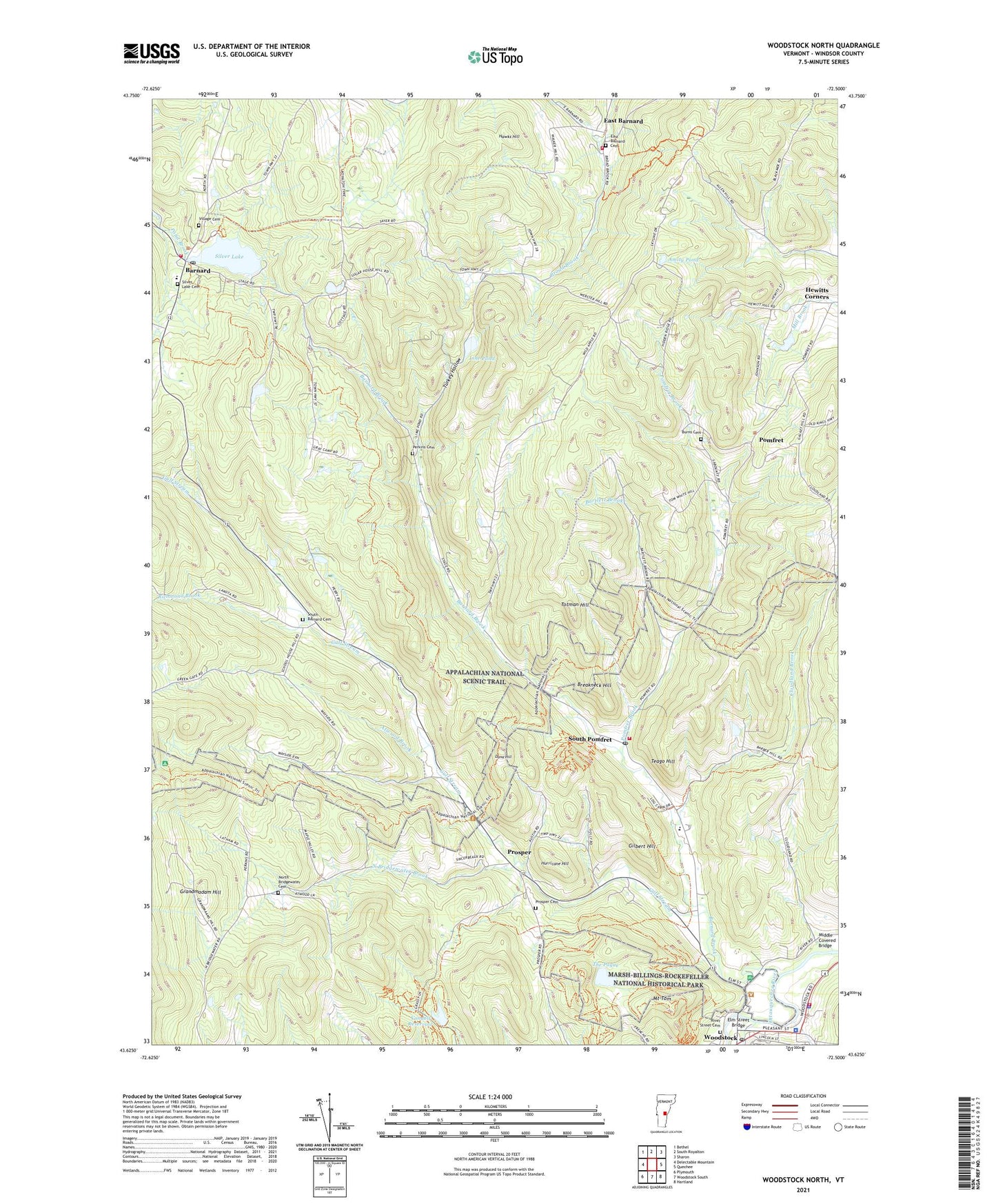
Woodstock North Vermont US Topo Map
Couldn't load pickup availability
Also explore the Woodstock North Forest Service Topo of this same quad for updated USFS data
2024 topographic map quadrangle Woodstock North in the state of Vermont. Scale: 1:24000. Based on the newly updated USGS 7.5' US Topo map series, this map is in the following counties: Windsor. The map contains contour data, water features, and other items you are used to seeing on USGS maps, but also has updated roads and other features. This is the next generation of topographic maps. Printed on high-quality waterproof paper with UV fade-resistant inks.
Quads adjacent to this one:
West: Delectable Mountain
Northwest: Bethel
North: South Royalton
Northeast: Sharon
East: Quechee
Southeast: Hartland
South: Woodstock South
Southwest: Plymouth
This map covers the same area as the classic USGS quad with code o43072f5.
Contains the following named places: American Legion House, Amity Pond, Amity Pond Natural Area, Atwood Brook, Barnard, Barnard Brook, Barnard Central School, Barnard Post Office, Barnard Volunteer Fire Department, Bartlett Brook, Billings Farm Museum, Billings Park and Trails, Breakneck Hill, Broad Brook Volunteer Fire Department, Burns Cemetery, Cloudland Brook, Dana Hill, Dana House Museum, East Barnard, East Barnard Cemetery, East Barnard Church, Elm Street Bridge, First Congregational Church, Frost Mill, Gilbert Hill, Grandmadam Hill, Gulf Stream, Hawks Hill, Hurricane Hill, John Cotton Dana Library, Kedron Brook, Klose Dam, Line Pond, Marsh-Billings-Rockefeller National Historical Park, Masonic Temple, Middle Covered Bridge, Mount Tom, North Bridgewater Brook, North Bridgewater Cemetery, Ottauquechee Health Center, Perkins Cemetery, Pomfret, Pomfret Brook, Pomfret Elementary School, Prosper, Prosper Cemetery, Richmond Brook, River Street Cemetery, Silver Lake, Silver Lake Camping Area, Silver Lake Cemetery, Silver Lake Chapel, Silver Lake Dam, Silver Lake State Park, Sonneberg Ski Area, South Barnard Cemetery, South Pomfret, South Pomfret Post Office, Suicide Six Ski Area, Teago Hill, Teago Volunteer Fire Department, The Pogue, Totman Hill, Town of Barnard, Town of Pomfret, Tribou Park, Turkey Hollow, Village Cemetery, Vondell Reservoir, Vondell Reservoir Dam, Windsor County Sheriff's Department, Woodstock Ambulance Service, Woodstock Church of Christ, Woodstock Community Correctional Center, Woodstock Community Correctional Center Library, Woodstock Fire Department, Woodstock Historical Society Building, Woodstock Police Department, Woodstock Post Office, Woodstock Town Forest, Woodward School, ZIP Codes: 05031, 05067, 05091